Yesterday afternoon, about 50 or 60 people showed up at the Dena'ina Center to look at maps lining the walls and to testify about what they liked or didn't like about the maps.
These were state maps and Anchorage maps mostly, created by the Board (versions 3 and 4) and by the four 3rd party maps that the Board voted to show around the state.
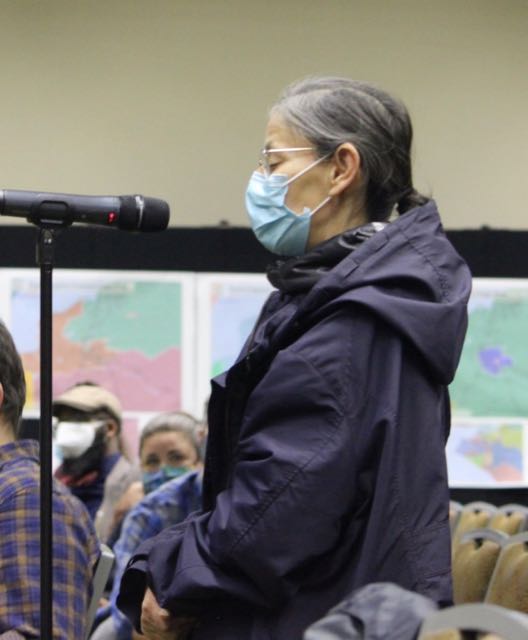
There was also testimony by 18 or so people. Everyone wore masks, though most folks took them off while testifying which they did a long ways from anyone else. They were required and there was a supply available at the sign in desk. There was a lot of room, though people did get fairly close in some cases to talk about the maps. Here's a brief version of the kind of things people said. Excuse me if I don't get all they said, or worse, if I mix it up a bit.

Gil Stokes talked about the removal of a polling place where he lived and how difficult this made it for the many people who were older and that he hoped they would reinstate this place to vote. Board member Nicole Borromeo said she'd refer his message to the Division of Elections who made those decision.
Alex Baker complained that in the Board's maps (I think) his neighborhood - Fairview - had been split into three different districts. This would mean common issues for the neighborhood, like problems with Merrill Field wouldn't get the attention they need if they were represented by one person. There were also issues about the businesses along Ingra and Gambell being split into different districts. He generally favored the AFFR map.
Alex Jorgerson also favored the AFFR map. In one map (the Board's?) Taku-Campbell area was split up in ways that did not reflect the neighborhood. There was something about 3 different schools.
Kim Hays said she was from the Raspberry-Dimond area also preferred the AFFR map. And if not AFFR the Board's v4 with AFFR's version of her district.
Steve Colligon, one of the AFFER map makers, said there was a new version of the map they wanted to submit for the record.
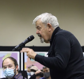
Then Randy Ruedrich, also from AFFER, expanded on Steve's comments. He said they'd found a unique way to deal with the excess people in the north Fairbanks area. [Excess people just means that when you divide the population into equal 18,335 districts, Fairbanks ends up with left over people who have to be paired with people from elsewhere to make another whole district.] In the past he said they'd put them into District 5 that wrapped around Fairbanks and took up much of the Interior. Now he'd found an ingenious way to create a good district out of them. He also mentioned that the Alaska constitution requires maps pay attention to natural geographic boundaries like rivers.
Normally, if someone is facing left, I'd try to put them on the right side of the post, like with Ruedrich above. But everyone was facing left, from where I was. So I figure moving the pics around is more interesting. But they were all facing the front table where Board member Nicole Borromeo was listening and taking notes.
She told Steve and Randy that they weren't going to accept any new official maps, but would take the changes into consideration. In the picture here, the person to her right is staff member TJ Presley. He quickly moved over to near where the mic was so that he could change mics between speakers and clean off the one just used.
The other Board member at the meeting was Bethany Marcum who stayed near the maps so she could answer questions from people looking at the maps.
Retired dentist Jason Rampton, gave his coming to Alaska with the military story and wanted to emphasize that many active and retired military live in Eagle River and so connecting the bases with the ER area made good sense. He said half of Eagle River was active and retired military and I'm still wondering how to fact check that.
Jason Lesard from District 23 was next and I just forgot to take his picture. He suggested that the Board include copies of the current districts at these presentations so people can compare them to the maps on the wall.

Emily Becker complained about the constant references to the Supreme Court ruling that all of Anchorage was one Socio-integrated unit and so neighborhood considerations didn't need to be taken into consideration. She argued that there were lots of diverse populations and their community voices were lost by dividing them into separate districts. [This is not different from what Dr. Rampton was saying about ER.]
At this point, the Board's administrator pointed out that the Board's office in the University Mall was open and people could call and order paper maps and then pick them up. Or drop in, but if they called first, they wouldn't have to wait for someone to put a packet of maps together.
I think this is Stanton Moll. (If not my apologies to Moll and to this speaker.) My notes say he preferred AFFR particularly because it heeded the advice that JBER should be divided according to the gates, because those locations are where people on the base interact most with the community.
Jordan Harary began reciting the motto on US currency - E Pluribus Unum - Out of Many, One. He emphasized that today this was no longer true. We are a divided nation. He said there are political players trying to make the maps more Democratic and more Republican. He urged the board not to let that happen and said he favored the Doyon map.
[I pulled out a $5 bill to check the spelling of E Pluribus Unum. I figured that was faster than googling. Only the E Pluribus part was showing. The Unum was covered by a seal. I couldn't find the words anywhere on a $1 or a $20. I'd also note that despite all the rhetoric about being divided, I'm convinced that a relatively small percentage of the population is seriously divided from the rest. But they are really noisy. I base this on
the fact that 57% of US adults are fully vaccinated and 66% have had at least one shot. That means only 34% haven't been vaccinated. Some for legitimate reasons, and the rest because . . . But conflict gets clicks and eyeballs and most media can't resist using alarming headlines. And after a while they believe it.]

Kevin McGee, from the local NAACP, was concerned that the diverse populations of Anchorage not get divided and are fully represented. He emphasized the one person one vote standard and the other three key requirements. He preferred the AFFR map. Didn't particularly like the AFFER map or the v3 and v4 maps. He was against the minority votes of Government Hill and Muldoon being lost by pairing them with Eagle River. He liked that the Doyon maps gave Doyon members power in their own districts and didn't match them with North Pole. His final words were to use AFFR and Doyon maps.
Nora Morse (I hope I've still got the names and pictures matching) preferred AFFR map because it follows community council neighborhood boundaries. [That's not true in my district. I'll try to use their map as an example of the problems of balancing deviation, compactness, contiguity, and socio-economic integrity in another post.]
I took advantage of being there and shared that at the previous round of redistricting,
the board didn't do the Senate pairings (indicating which House districts would be paired into Senate seats) until the last week before final approval there was no public testimony taken at that point. So I was recommending that the current Board make sure there's opportunity for public testimony about the Senate pairings before the new plan is finalized. [I'd note also that in looking up that post from last time, I saw that in that last week of the 60 Board process before approving the plan, June 7- 12, 2011 they also discussed
metes and bounds and
truncation. Two arcane processes that are discussed in those posts that week in 2011. You can use the links to prepare ahead for those actions. Metes and bounds is more technical mapping and describing the boundaries. Truncation is deciding which current Senate seats will be shortened or lengthened to maintain staggered terms - 1/3 of the Senate is up for election every two years.]
I couldn't take my own picture while I was testifying and then forgot the next two.
Kimberly Collors(sp?) is involved in her community council. She wanted to know what the Senate pairings would be. Something about the Muldoon curve and the East Anchorage Community Council being split. Appreciates v4 ??? Likes that AFFR map respects downtown.
Tasha Holeh from Mt View liked the Doyon map.
Louise Donhauser talked about Mt. View and the large homeless population.
Lois Epstein, from downtown Anchorage, pointed out that if you start mapping from the north you end up with a very different map than if you start from the south. Instead, she said you should start with neighborhoods. She also said that leaving out incumbent information doesn't really prevent gerrymandering. The Board should be transparent and put that information in. On the assumption that house districts would be paired in order, she said District 23 should be 22 so that Government Hill would be paired with East Anchorage. And that AFFER was unacceptable.
Finally Don More said that as he testified before he's from West Anchorage and he thought v4 did a good job of West Anchorage. He also mentioned AFFER following drainage patterns.
To the folks who testified, I hope I didn't distort your words or meaning. And hope you are upset with your pictures or lack of pictures. If you do have a problem, please leave a comment so I can fix it.


No comments:
Post a Comment
Comments will be reviewed, not for content (except ads), but for style. Comments with personal insults, rambling tirades, and significant repetition will be deleted. Ads disguised as comments, unless closely related to the post and of value to readers (my call) will be deleted. Click here to learn to put links in your comment.