Friday, October 15, 2021

Tomatoes And Other Odds And Ends


Red tree and clouds.  A bit of urban natural beauty.  


Here are some of the tomato seedlings last April 20.  Tomatoes don't do well in Alaska.  It has to stay above 50˚F (10˚C) at night for them to bear fruit.  But I found a sub-arctic variety that was supposed to bear down to 40˚F.  I left some inside by a south facing window, put some in the greenhouse in the backyard, and left one outside.  The one outside had the strongest plant - it had a sturdy stem, didn't get all leggy, and had lots of flowers and a dozen or more little tomatoes.  The ones inside (the house and the backyard greenhouse) also did well, but were not very strong.  They grew much taller and needed lots of stakes to keep them from falling over, or worse, breaking.  But we have been getting cherry size tomatoes since early September.  But then I decided I needed to bring them in when we had snow warnings.  So here are some I picked the other day.  Some are the smallest tomatoes I've ever seen - pea size.  


I enjoyed my tomato plants this summer, but it also proved my basic sense of tomatoes in Alaska - they aren't worth the effort.  I'd rather spend the time of plants that reward more spectacularly without all the work.  I still have some plants inside by the windows with small green marbles and lots of yellow flowers.  Let's see how many tomatoes we end up with.  I'd say we've had maybe 20, but not a lot in total volume.  


So when I made a couple of breads yesterday - the sour dough starter wants me to use it at least every two weeks - I made one rosemary/olive bread and one tomato/basil.  One gets eaten right away, the other goes in the freezer.  I wanted to try the tomato bread since I've never made one before, but I sliced the wrong one, so I'll have to wait a week to learn how it came out. 


 I really wanted to get the shiny asphalt covered apparatus at the back of this truck, but I was on my bike and he was moving.  But I had to settle for the wet new layer in the street.  


I decided I would like a wall with this wall paper in one room


Wednesday, October 13, 2021

Libraries And Schools Are Targets In GOP War Against Truth

First Anchorage mayor Dave Bronson appointed a library director who didn't meet the minimum qualifications of the job description - a masters in library science and some years experience working in libraries.    When the Assembly didn't approve her, he appointed a second unqualified head librarian who isn't likely to be approved. (Or maybe they've already voted her down, there's so much nonsense going on it's hard to keep all the details straight. I can't find proof one way or the other.)

So now he's reorganizing the city through his budget which, according to Cheryl Lovegreen would  put the library into the Department of Parks and Recreation which changes the head librarian to a position that doesn't need Assembly approval. 

In an earlier post I pointed out that these actions are deliberate and that the GOP is pushing library takeovers around the country.  

I don't know how much of this Mayor Bronson consciously understands and how much he is just following the party instructions supported by the various national anti-think tanks and those organizations set up to get ideologically driven legislation passed at the state and local level.  

In the earlier post on taking over libraries, I'd found that a key goal is to purge libraries of books about race, about the history of race relations, that discuss diversity in a positive way.  It's part of the anti critical race campaign.  Mustn't allow people access to alternatives to the sacred myths of US exceptionalism.  

All of this is about lying on a pretty spectacular scale.  Lying as a form of keeping the masses ignorant, as a way to make them believe in an alternative reality.  It's how you create a cult of followers who deny what's in front of their own eyes and accept what their leader tells them.  

What's this got to do with libraries?   Lying isn't new to politics. 

"Secrecy - what diplomatically is called discretion," as well as the arcana imperil, the mysteries of government - and deception the deliberate falsehood and the outright lie, used as legitimate means to achieve political ends have been with us since the beginning of recorded history. Truthfulness has never been counted among the political virtues, and lies have always been regarded as justifiable tools in political dealings.

--Hannah Arendt (1971) “Lying in Politics: Reflections on The Pentagon Papers”, 


The Trump presidency took lying to a new level, at least in the US.   Journalists kept tab of how many lies he told in a day.  Twitter made it easier to track. And people are saying things like, "the lying was the point." But it's more than that.  Politicians have always lied about their opponents so they could take over their jobs.

Now it's a frontal attack on truth itself.  The constant denial of truth and the ways we evaluate and measure what is true, is intended to destroy people's confidence in education and in science.   It's an attack to take over as the arbiter of what is true.

If we look at the evolution of intentional lying in the modern United States, of well funded and scientifically based (science was used to determine the best ways to convince people, not to seek the truth) campaigns, we see things like the tobacco industry's decades long campaign to convince the US public that smoking was not bad for your health (for example here and here.) and the oil industry's campaigns denying climate change.  Both industries knew they were lying.  We see it again today with COVID.  People earn lots of money packaging and selling lies. These are just the big ones that have been exposed. There are thousands of lesser ones to get people to by 'health food' or to lose weight and on and on and on.  

But counting the lies and offering scientific evidence that 'prove' the inconsistencies are all besides the point.  The new GOP is now about obliterating truth.  By creating false realities, they can challenge science itself.  Trump may or may not believe he really won the election. (I tend to think he knows the truth, but he's also enough of a narcissist that he maybe can't imagine he didn't win.  I don't know.)  By still challenging the election, he cultivates the doubts of his supporters, and hopes to harvest their votes in the future. And to cast doubt on the legitimacy of any election he loses.

They have to lie and to eradicate any kind of objective truth because the truth does them no favors.  The US Justice system has huge flaws that favor the wealthy and the white and delivers injustice to the poor and the people of color.  But they have to maintain the facade that it is fair, at least when it punishes the poor and not-so white.  The economic system now takes from the poor and gives to the rich through systemic laws and rules that make it hard, if not dangerous, for workers to unite for better pay and better working conditions.  Their unions that fought for 40 hour weeks and vacations and overtime pay and fair grievance procedures have been gutted.  But they must maintain the fiction that if you work hard and honestly you'll do well.  

The elimination of any sort of verifiable truth gives the GOP the possibility of splitting the population and continuing to get many to vote against their own self interest.  They do this by creating an emotional self interest based on race, religion, abortion, immigration.  It's built on a quarter truth and three quarters lies. (No, I have not measured the truth ratios.  Think about this metaphorically.)


Thus They Want To Gut Libraries And Schools

So, if elimination of truth and the ability to evaluate what is true is the GOP goal, then it makes perfect sense for them to go after libraries and schools - all levels - and to go after libraries.  Because these are institutions that give average people access to the truth.  And access to alternative truths and to logic and science.  


Our governor's drastic cuts to the University of Alaska are a similar effort to destroy public universities.  I also believe that schools are prime targets of private takeovers.  But that idea distracted me from recognizing the other, larger,  goal - obfuscating truth.  


Viktor Klemperer (cousin of conductor Otto Klemperer) was a distinguished university professor and WW I veteran when Hitler came to power.  Klemperer kept a diary during WWII - I Will Bear Witness in two volumes - where, among other observations,  he kept notes on the language used by the Nazis in their speeches and in the news.  This later resulted in The Language of the Third Reich: A Philologist's Notebook.

These books are careful studies of how the Nazis manipulated language to hide truths they didn't want the German people to hear and to believe the truths the Nazis wanted them to believe.  

Good lesson for citizens of the United States to learn.  

And since I brought Nazis into the discussion, I had found the GOP's embrace of White Supremacists AND their flipping this completely by crying that they are victims of Nazi like suppression of liberties (for having to wear masks, for example) pretty bizarre.  

But on reflection, it's part of obliterating any kind of objective truth.  We are Nazis and we are the victim of Nazis.  Consistency and truth broken, leaving logical thinkers sputtering in disbelief.  That is the point.  To capture truth and make it their own way to rule the world.  

Tuesday, October 12, 2021

Saying No To Hate At Loussac Library

 Here are some pictures from the rally for civility being put on by @ANCGov at Loussac this afternoon.  Couldn't have been a nicer day.  It's was scheduled to 6:30.  I took off after an hour.  


There was a counter demonstrator with a mic and speaker keeping up a constant monologue challenging the idea of the of masks and the vaccine.  It was like a mosquito buzzing around you when you're outdoors.  Not sure what the guy on the left was saying, but the security guard came over and told him to back up.  

Sorry, this sign is out of focus, but it was the most unique, so I'm including it.


My rough count from up on the grassy hill was 70-80 folks.  Not a big crowd, but respectable.  


Sunday, October 10, 2021

Green Acres: An Example Of How Redistricting Maps Move A Self Contained Neighborhood Around [Updated]]

[I've been working on this post a few days now and it still doesn't feel right, but I think I just need to put it up and move on.]

 [UPDATE Oct 12, 2021: The key change is that Rep. Spohnholz, not Rep.Tarr would be the Doyon map.  But I did some grammatical fixes while I was at it.]

Green Acres is a little self contained neighborhood southwest of UAA.  A black business woman homesteaded the area in the 50s, according to a neighbor who had been here from early on.  She then sold parcels to other black families who had trouble buying in other parts of Anchorage.  That probably also accounts for why no streets go through to any of the adjoining neighborhoods.  There are only three outlets - one to 36th and two to Lake Otis.  When it was homesteaded 36th didn't go through to Lake Otis.  When we moved into the neighborhood in the late 1970s, both 36th and Lake Otis were still two lane roads.  As the original owners passed away, and it got easier for blacks to live in other neighborhoods, the neighborhood changed, but it still has some of the original families as well as a diverse population.  It's a mix of single family homes, duplexes, triplexes, and four-plexes.


I've outlined Green Acres  in red (sorry, but red shows up much better than green).  You can see it's on the south west corner of Lake Otis and 36th.  None of the streets connect to the pricier neighborhoods to the west or south.  Only three streets exit Green Acres:  Randolph onto 36th, and 37th and 38th onto Lake Otis.  Across Lake Otis is some UAA land, and medical offices, then McLaughlin Youth Center.  South along Lake Otis is medical offices.  North is 36th and there is no entrance to the neighborhoods there until you go much further west to Vassar.   So Green Acres is a pretty self-contained neighborhood.  

Why am I telling you all this?   

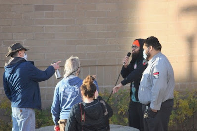
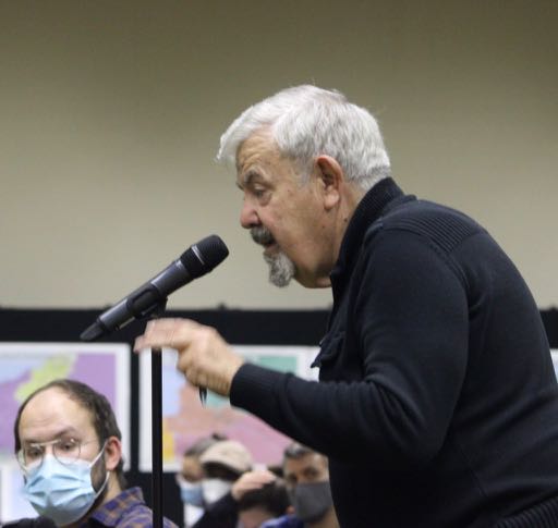
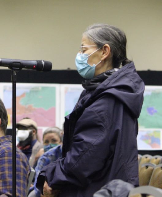
At the Anchorage Redistricting Board map show-and-tell and public testimony a week ago Friday, I was looking at an AFFR map on the wall and saw that a section of Green Acres had been split off from the rest of the neighborhood.  I couldn't tell from the size of the map at the time, but it was close to 1/2 of Green Acres put into a district that had no real adjoining residential section.  So neighbors in the small community would be split into two different house districts and senate districts.  I talked to one of the AFFR mappers that night and followed up with an email with more details.  [By the way, I'm calling AFFR's district 15-H "the flying pig" though I'd accept "the flying bear" as well.]


So this exercise led me to write a  blog post about how to make some sense of all the maps. (I think it's a useful post for Alaskans, and maybe others in other states.)  There's way too much information for people to check all the districts in all the maps.  

So I recommended that people just find their own house on the six maps plus their current district and compare them.  As a way to get a better sense of what the different mappers did to their neighborhood, district, and representative and senator.

That's what I then set out to do for my neighborhood.  .  And you can too.  Here's the link to the map page on the Redistricting Board site.   There are six plans:

  • Board v3 (version 3)
  • Board v4
  • AFFER (Alaskans for Fair and Equitable Redistricting) - the GOP group
  • AFFR (Alaskans for Fair Redistricting) - unions and native organizations and others
  • DOYON Coalition - A group of Native organizations
  • Senate Minority - Democrats in the State Senate

Under each plan you have a choice of different kinds of formats.  I recommend to start off with the top one - the interactive map - so you can zoom in and out as you please.  

Near the bottom on the left are the 2013 Proclamation Maps where you can get a map of your current district.  

So here are my maps and things I learned.  

My Current District  [Note:  I drew a green outline around Green Acres, but on these maps it's hard to see, so I added the big green star.  Green Acres is at the 5 o'clock point of the star in all the maps. You should also be able to see UAA kitty-corner on the north-east side of Lake Otis and 36th.  These maps are all higher resolution than normal, so you can click them to make them bigger and sharper.]


So, now my neighborhood is in the north-west corner of my district (though the north-east corner goes further north).  UAA is in my district which goes south to Dowling and east to Elmore and along the edge of the UAA/APU parklands.  More or less.  It's not that clean.  Or in redistricting language, compact, meaning it's not a perfect square.  But it is compact in the sense that a person (like a candidate trying to go door to door) could walk from the southwest corner to the northeast corner easily.  Google maps sets a walking distance of 4.6 miles and a time of 1 hour and 31 minutes.


Board's V3 - District 16


We change from a generally squarish district with a north-south orientation, to a long rectangle.  Maybe a truck shape.  Green Acres moves from the north-west corner closer to the south-east corner.  We go from Piper/University Drive on the east (cutting UAA in half) all the way west past Wisconsin to Aero, almost in Earthquake Park.  North is along Northern Lights and the south boundary is basically Tudor.  Google maps say it's 5.3 miles from the SE corner to the NW corner by foot.  You could walk it, they say, in 1 hour 53 minutes.   I'd also note, after looking at Alaska Landmine's maps with state representatives homes marked, that this district has NO incumbents living it it.  It is hard for me to imagine how that can happen by accident.  My current representative lives south of Tudor which is across the border.  


Board's V4 - District 13


This map also moves me from the NW corner to the East of my district.  In other words it moves my district west and north.  And makes it an east-west rectangle not a north-south one.  But it seems more compact than V3.  It goes from Lake Otis and Northern Lights in the NE to Northwood and International Airport Road.  Google says you can walk 3.4 miles from the NE to the SW  in 1 hour and 7 minutes. While it follows squiggly Fish Creek along the east, it uses Tudor and International Airport Road as a southern border.   Again, it looks like v4, like v3, does a good job of carving out by five or six blocks my current representative Josephson and puts him in a district with another Democrat, Chris Tuck.  And from what I can tell, leaves District 13 with no incumbents.  

AFFER - District 24


There's a pattern here.  The two Board maps and the AFFER map all move my district north of Tudor which conveniently removes my current representative from my district and, apparently into the same district as Rep. Chris Tuck.  And then moves the district to the west so my neighborhood moves from the west end of the district to the east end. 

This map also changes the orientation from the old north-south to an east-west.  This map uses Chester Creek as a northern boundary and a very straight Tudor Road as a southern boundary.  The east looks like a fish with its mouth open but is largely Lake Otis from Tudor to Northern Lights.  

 This map does appear to have one incumbent in it - Harriet Drummond.

Google says 4.8 miles 1 hour 34 minutes from Folker and Tudor in the SE to the Westchester Lagoon Overlook in the NW.  

AFFR   - District 15 H


Like the others, it shifts my district east-west.  Well, I can't say that really, because this is the one I started with that pulls me and some of my neighbors out of our little self contained neighborhood and puts us in an isolated group not physically connected to any other residential neighborhood.  And as I write this I realize I've been in denial with this map, because I'm no longer with my Green Acres neighborhood and this flying pig shaped district.  This district does include my old representative Andy Josephson, but not me.  

From southeast toe to the northwest ear tip Google tells us is 5.4 miles or one hour 45 minutes walk.

While this started with my house, this quickly became about Green Acres, and in the AFFR maps, Green Acres is in two different districts.  So let's look at the other AFFR district where the other half of Green Acres goes.  

AFFR - District 18-I   


Another east-west orientation.  Part of Green Acres is now on a south border, in the middle between east and west.  It appears that Rep. Geran Tarr lives in this district.  Some of this area was well within my old district.  

Google says from the NE corner at Boniface and Debarr to the SE corner at Arctic and 36th is 5.1 miles, or a one hour and 39 minute walk.  


DOYON Coalition - District 17-I

Another east-west orientation.  On the east Boniface Parkway from just north of Northern Lights to just south of Tudor.  Then it uses Tudor for a southern border to the Seward Highway. Turns north along Seward Highway to 36 the west again to Arctic.  Arctic is the east boundary.  The northern boundary starting east at Boniface, goes along Reka Dr to Bragaw. Then it takes 20th to Rosemary, the Cassius to Thunderbird to 18th Circle.  Then I'm not sure what line it's following to get up to 16th and eventually gets up to Debarr.  From what I can tell, it splits up Airport Heights.  Then it gets over to Chester Creek and follows it to Valley of the Moon.  

Google says it's 5.2 miles one hour 39 minutes  from Boniface and 40th on the southeast corner of the district to Valley of the Moon Park on the northwest corner.  

I think that Geran Tarr  [@alaskanrobby says it's Ivy Spohnholz] is in this district, but on the Landmine map it's hard to tell exactly since the Doyon maps wanders in and out of the Airport Heights neighborhood.  I don't think any other representatives are in the district.  


Senate Minority Coalition - District 20-J


This map is the only one that keeps the district basically vertical.  But It takes the district south, keeps it narrow.  It's the only one of the maps that keeps my neighborhood in Rep.Josephson's district.  The Flying Pig district from AFFR does too, but my house was cut out of that district.

It basically starts at Northern Lights between Old Seward to Lake Otis and takes that narrow swath south.  At Dowling it protrudes to the east and stops at Lore in the south.  

Google says 4.8 miles or one hour and 36 minutes to walk from Elmore and Lore in the SE to Northern Lights and Seward Highway on the NW.


Observations and Conclusions

First a table pulling out some factors I could use for comparison.  There are two AFFR maps.  AFFR1 map is the the western half of Green Acres.  AFFR2 is the eastern half of Green Acres.


Board v3 Board v4AFFERAFFR1AFFR2DOYONSENATE
Minority
District 16 13 24-L15-H 18-I 17-I 20-J
Walking
Distance
5.3 mi 3.4 mi 5.2 mi 5.4 mi 5.1 mi 5.2 4.7
Incumbent none none Drummond Josephson Tarr 
Tarr
[Spohnholz]
Josephson
Deviation -74/0.41% -330/1.8% +128/.70% -20/0.11% +4/0.02% -141/-0.77 +5/+0.03


1.  All four of the independent map makers were able to identify Senate pairings, but the Redistricting Board did not.  The board's attorney Matt Singer said they were required to do the house districts but not the Senate pairings.  Here's what the Alaska Constitution says:

§ 10. Redistricting Plan and Proclamation

(a) Within thirty days after the official reporting of the decennial census of the United States or thirty days after being duly appointed, whichever occurs last, the board shall adopt one or more proposed redistricting plans. The board shall hold public hearings on the proposed plan, or, if no single proposed plan is agreed on, on all plans proposed by the board. No later than ninety days after the board has been appointed and the official reporting of the decennial census of the United States, the board shall adopt a final redistricting plan and issue a proclamation of redistricting. The final plan shall set out boundaries of house and senate districts and shall be effective for the election of members of the legislature until after the official reporting of the next decennial census of the United States. [emphasis added]

While the Constitution doesn't say the first proposed plan has to have senate districts, neither does it say it has to have house districts.  Only for the final plan does it say either house or senate, so I'm not sure why the Board's attorney thought that senate pairings in the original proposed plans were any less important than the house seats in the final plan.  All the 3rd party plans managed to include Senate pairings.  

I suspect that 'setting out boundaries' means 'metes and bounds' - a process the staff does at the end which is to describe the physical boundaries of the districts.  I've done a very abbreviated version of that in my descriptions.  Here's a post on Metes and Bounds I did in 2011 redistricting process.

2.  Most of the maps changed my current district from a north-south orientation to an east-west orientation.  

3.  The most distant points of each of the districts are all within 2 miles - 5.4 being the highest and 3.4 being the lowest.  Those points for each district should be walkable in 2 hours or less according to Google maps.  So there's really no problem with compactness.  The largest state districts are hundreds of miles of roadless wilderness.  Google maps couldn't tell me distances, for example, from Kaktovik to Point Hope.  Expedia says it's 922 km which is 572 miles, presumably by air.  

4.  While the Board adopted a policy at the beginning, to not protect incumbents, they have not made a policy to not target incumbents.  The Board's v3 and v4 maps both pair a number of incumbents and leave my district, for example, without an incumbent.  It's hard for me to believe that didn't happen intentionally.  I recently read an article - which I can't relocate - that said the first maps, no matter how much they are later adjusted, set the pattern.  The Board's v1 map of Anchorage put a number of Democratic incumbents into one district.  It also made the maps in an east-west orientation instead of a north-west orientation.  The second map, v2 was done quickly by another board member, but it's hard to adjust from that first orientation.  The current Board maps are modifications of v1 and v2.  We still have incumbents put together in the same districts.  It seems Democrats and moderate Republicans more than hard-line far right Republicans.  @Alaskanrobby has made maps showing those groupings.  

As you can probably tell, I'm still trying to make sense of all of this, I know more than I did when I started this post and the review of the maps.  I also have a lot more questions. 

If you try this, it should be easier, because you don't have to then write a post about it.  But the writing exercise does force one to clarify things.  Good luck.   

Saturday, October 09, 2021

Swans At Taku Lake on Sunny Grey Day

You can listen to this song as you read.  It should make sense by the end.  


The sun kept a steady beam shining through the clouds as I biked over to Taku Lake today.  I reached my 745 km goal (a vicarious bike ride from Chiangmai to Bangkok) on September 13.  There's a tension between the benefits of riding the bike outdoors regularly and how my knees feel.  It's obvious that three or four days without being on a bike makes my knees feel much better.  I can live with a little pain if I know that the damage done is temporary.  (It doesn't hurt while I ride, just later on.)  


But there was still good biking weather and so I made a new goal.  800 kilometers.  I reached that goal October 4.  So what next?  A quick and dirty calculation of .6 * 800km got me to 480 miles, so I needed 20 more miles to get to 500 miles.  That would be about 32 more kilometers.  It's not all that important and I didn't set out to go that far today.  But the weather was good, everything was beautiful and a changing seasons way, and I got to Taku Lake feeling good.  


At the south end of the lake were four swans (and a number of smaller and darker water birds) taking a rest on their way south.  


Then back home with a stop on one of the many bridges that cross over the meandering creek to  get a picture of the sun's reflection (maybe glare is a more apt term) on the creek.  Although the sky was mostly grey, the sun made its presence known most of the way.  


It ended up being 13+ kms.  All but about three kilometers were on dedicated bike trail in the greenbelt that buffers the creek from residential and commercial streets.  There's only one non-residential street that I have to cross.  So I now had 816.5 kms for the summer.  Time to check precisely how much more before I hit 500.  So I googled 500 miles = x kms.  Turns out the simple .6 rounds off more than I thought.  804km = 500 miles. 
 I was already there when I started.  So know I'll just ride until it's icy on the trails.  Winter biking, will be on the bike with studded tires and only for short distances if there's what used to be a normal snow covering - without ice.  

Meanwhile, I'm working on a post on how the different redistricting plans move me from one district to another.  Enjoy your Sunday.  Find something wonderful - whether it's the bark on a tree or an old picture of people you love.  

Friday, October 08, 2021

I'm Punting Here, But Edward Snowden Is A Smarter And Better Writer Than I

I'm working on posts related to COVID and our mayor, and on redistricting, but it takes time to post something that's got something in it that everyone hasn't already heard. 

So when I read a Tweet by Edward Snowden - "On banking, bitcoin, and the future of money: a response to a governor of the Federal Reserve, Christopher J. Waller" - and then read the Substack article it was linked to, I knew I had something I could share while I continued working on (at least thinking about) my own posts.  

So, who is Waller?  Snowden tells us:

"Waller, an economist and a last-minute Trump appointee to the Fed, will serve his term until January 2030."

Waller was talking about whether the US government should create its own cryptocurrency in response to Bitcoin and other such currencies.  Snowden points out that China and a few other nations have already done this.  China, because it's a great way to keep track of how individuals are moving money around.  And government controlled cryptocurrency's biggest problem for Snowden, if I understand him, is the surveillance aspect of cryptocurrency.  

I'm impressed with how well Snowden writes.  He gets so much content into relatively few well chosen and organized words.  And he's really smart.  With a wicked understated sense of humor.  I don't understand everything he says, but with the endorsements of heroes like Daniel Ellsberg, I think what Snowden writes is worth paying attention to.  And his writing is just fun to read, even on a highly technical subject I don't know that much about.  But computers and surveillance are two subjects that Snowden is an expert on.  

There's even a history of money

For thousands of years priors to the advent of CBDCs, money—the conceptual unit of account that we represent with the generally physical, tangible objects we call currency—has been chiefly embodied in the form of coins struck from precious metals. The adjective “precious”—referring to the fundamental limit on availability established by what a massive pain in the ass it was to find and dig up the intrinsically scarce commodity out of the ground—was important, because, well, everyone cheats: the buyer in the marketplace shaves down his metal coin and saves up the scraps, the seller in the marketplace weighs the metal coin on dishonest scales, and the minter of the coin, who is usually the regent, or the State, dilutes the preciosity of the coin’s metal with lesser materials, to say nothing of other methods.

At the very least, this is an early warning for me (well others might say rather late) to pay more attention to cryptocurrency and what it might mean for the future of money.  And the ability of governments to monitor how people spend their money.  

So I'm strongly recommending the article.  Here's the link again.  Meanwhile, here are some quotes from the article.  

“Intermediation,” and its opposite “disintermediation,” constitute the heart of the matter, and it’s notable how reliant Waller’s speech is on these terms, whose origins can be found not in capitalist policy but, ironically, in Marxist critique. What they mean is: who or what stands between your money and your intentions for it.


This “crypto”—whose very technology was primarily created in order to correct the centralization that now threatens it—was, generally is, and should be constitutionally unconcerned with who possesses it and uses it for what. To traditional banks, however, not to mention to states with sovereign currencies, this is unacceptable: These upstart crypto-competitors represent an epochal disruption, promising the possibility of storing and moving verifiable value independent of State approval, and so placing their users beyond the reach of Rome. Opposition to such free trade is all-too-often concealed beneath a veneer of paternalistic concern, with the State claiming that in the absence of its own loving intermediation, the market will inevitably devolve into unlawful gambling dens and fleshpots rife with tax fraud, drug deals, and gun-running.  


Traditional financial services, of course, being the very face and definition of “intermediation”—services that seek to extract for themselves a piece of our every exchange. 

I think about how credit cards and Amazon make money simply by getting a percent of everything we buy, adding their own tax to everything consumers buy or businesses sell.  

I risk few readers by asserting that the commercial banking sector is not, as Waller avers, the solution, but is in fact the problem—a parasitic and utterly inefficient industry that has preyed upon its customers with an impunity backstopped by regular bail-outs from the Fed, thanks to the dubious fiction that it is “too big too fail.” 

Ultimately, Snowden says he agrees with Waller's conclusion that the US should not create its own crypto currency, but for a different reason.  

"And yet I admit that I still find his remarks compelling—chiefly because I reject his rationale, but concur with his conclusions.

It’s Waller’s opinion, as well as my own, that the United States does not need to develop its own CBDC. Yet while Waller believes that the US doesn’t need a CBDC because of its already robust commercial banking sector, I believe that the US doesn’t need a CBDC despite the banks, whose activities are, to my mind, almost all better and more equitably accomplished these days by the robust, diverse, and sustainable ecosystem of non-State cryptocurrencies (translation: regular crypto). " 

One key point that hasn't gotten into this post yet is surveillance 

I think I'm pushing the ethical limits on the amount I can quote from someone. Really, this is only fraction of what he wrote and I'm hoping that through his quotes I can entice you to click the link to his article.  Consider this post a trailer for his article. 

Tuesday, October 05, 2021

While There's Chaos At The Assembly Meeting, People Testify Calmly And Respectfully At Redistricting Board

Yesterday afternoon, about 50 or 60 people showed up at the Dena'ina Center to look at maps lining the walls and to testify about what they liked or didn't like about the maps.  


These were state maps and Anchorage maps mostly, created by the Board (versions 3 and 4) and by the four 3rd party maps that the Board voted to show around the state.  


There was also testimony by 18 or so people.  Everyone wore masks, though most folks took them off while testifying which they did a long ways from anyone else. They were required and there was a supply available at the sign in desk.   There was a lot of room, though people did get fairly close in some cases to talk about the maps.  Here's a brief version of the kind of things people said. Excuse me if I don't get all they said, or worse, if I mix it up a bit.  


 Gil Stokes talked about the removal of a polling place where he lived and how difficult this made it for the many people who were older and that he hoped they would reinstate this place to vote.  Board member Nicole Borromeo said she'd refer his message to the Division of Elections who made those decision.


Alex Baker complained that in the Board's maps (I think) his neighborhood - Fairview - had been split into three different districts.  This would mean common issues for the neighborhood, like problems with Merrill Field wouldn't get the attention they need if they were represented by one person.  There were also issues about the businesses along Ingra and Gambell being split into different districts.  He generally favored the AFFR map.


Alex Jorgerson also favored the AFFR map.  In one map (the Board's?) Taku-Campbell area was split up in ways that did not reflect the neighborhood.  There was something about 3 different schools.


Kim Hays said she was from the Raspberry-Dimond area also preferred the AFFR map.  And if not AFFR the Board's v4 with AFFR's version of her district.  


Steve Colligon, one of the AFFER map makers, said there was a new version of the map they wanted to submit for the record.  


Then Randy Ruedrich, also from AFFER, expanded on Steve's comments.  He said they'd found a unique way to deal with the excess people in the  north Fairbanks area. [Excess people just means that when you divide the population into equal 18,335 districts, Fairbanks ends up with left over people who have to be paired with people from elsewhere to make another whole district.]  In the past he said they'd put them into District 5 that wrapped around Fairbanks and took up much of the Interior.  Now he'd found an ingenious way to create a good district out of them.  He also mentioned that the Alaska constitution requires maps pay attention to natural geographic boundaries like rivers.  


Normally, if someone is facing left, I'd try to put them on the right side of the post, like with Ruedrich above.  But everyone was facing left, from where I was.  So I figure moving the pics around is more interesting.  But they were all facing the front table where Board member Nicole Borromeo was listening and  taking notes.  

She told Steve and Randy that they weren't going to accept any new official maps, but would take the changes into consideration.  In the picture here, the person to her right is staff member TJ Presley.  He quickly moved over to near where the mic was so that he could change mics between speakers and clean off the one just used.  

The other Board member at the meeting was Bethany Marcum who stayed near the maps so she could answer questions from people looking at the maps.  

Retired dentist Jason Rampton, gave his coming to Alaska with the military story and wanted to emphasize that many active and retired military live in Eagle River and so connecting the bases with the ER area made good sense.  He said half of Eagle River was active and retired military and I'm still wondering how to fact check that.  

Jason Lesard from District 23 was next and I just forgot to take his picture.  He suggested that the Board include copies of the current districts at these presentations so people can compare them to the maps on the wall.  


Emily Becker complained about the constant references to the Supreme Court ruling that all of Anchorage was one Socio-integrated unit and so neighborhood considerations didn't need to be taken into consideration.  She argued that there were lots of diverse populations and their community voices were lost by dividing them into separate districts.  [This is not different from what Dr. Rampton was saying about ER.]

At this point, the Board's administrator pointed out that the Board's office in the University Mall was open and people could call and order paper maps and then pick them up.  Or drop in, but if they called first, they wouldn't have to wait for someone to put a packet of maps together.  


I think this is Stanton Moll.  (If not my apologies to Moll and to this speaker.)  My notes say he preferred AFFR particularly because it heeded the advice that JBER should be divided according to the gates, because those locations are where people on the base interact most with the community. 

Jordan Harary began reciting the motto on US currency - E Pluribus Unum - Out of Many, One.  He emphasized that today this was no longer true.  We are a divided nation.  He said there are political players trying to make the maps more Democratic and more Republican.  He urged the board not to let that happen and said he favored the Doyon map.  

[I pulled out a $5 bill to check the spelling of E  Pluribus Unum.  I figured that was faster than googling.  Only the E Pluribus part was showing. The Unum was covered by a seal.  I couldn't find the words anywhere on a $1 or a $20.  I'd also note that despite all the rhetoric about being divided, I'm convinced that a relatively small percentage of the population is seriously divided from the rest.  But they are really noisy.  I base this on the fact that 57% of US adults are fully vaccinated and 66% have had at least one shot. That means only 34% haven't been vaccinated. Some for legitimate reasons, and the rest because . . . But conflict gets clicks and eyeballs and most media can't resist using alarming headlines.  And after a while they believe it.]


Kevin McGee, from the local NAACP, was concerned that the diverse populations of Anchorage not get divided and are fully represented.  He emphasized the one person one vote standard and the other three key requirements.  He preferred the AFFR map.  Didn't particularly like the AFFER map or the v3 and v4 maps.  He was against the minority votes of Government Hill and Muldoon being lost by pairing them with Eagle River.  He liked that the Doyon maps gave Doyon members power in their own districts and didn't match them with North Pole.  His final words were to use AFFR and Doyon maps. 


Nora Morse (I hope I've still got the names and pictures matching) preferred AFFR map because it follows community council neighborhood boundaries.  [That's not true in my district.  I'll try to use their map as an example of the problems of balancing deviation, compactness, contiguity, and socio-economic integrity in another post.]


I took advantage of being there and shared that at the previous round of redistricting, the board didn't do the Senate pairings (indicating which House districts would be paired into Senate seats) until the last week before final approval  there was no public testimony  taken at that point.  So I was recommending that the current Board make sure there's opportunity for public testimony about the Senate pairings before the new plan is finalized.  [I'd note also that in looking up that post from last time, I saw that in that last week of the 60 Board process before approving the plan, June 7- 12, 2011 they also discussed metes and bounds and truncation.  Two arcane processes that are discussed in those posts that week in 2011.  You can use the links to prepare ahead for those actions.  Metes and bounds is more technical mapping and describing the boundaries.  Truncation is deciding which current Senate seats will be shortened or lengthened to maintain staggered terms - 1/3 of the Senate is up for election every two years.]

I couldn't take my own picture while I was testifying and then forgot the next two.


Kimberly Collors(sp?) is involved in her community council.  She wanted to know what the Senate pairings would be.  Something about the Muldoon curve and the East Anchorage Community Council being split.  Appreciates v4 ???  Likes that AFFR map respects downtown.

Tasha Holeh from Mt  View liked the Doyon map.  


Louise Donhauser talked about Mt. View and the large homeless population.  


Lois Epstein, from downtown Anchorage, pointed out that if you start mapping from the north you end up with a very different map than if you start from the south.  Instead, she said you should  start with neighborhoods.  She also said that leaving out incumbent information doesn't really prevent gerrymandering.  The Board should be transparent and put that information in.  On the assumption that house districts would be paired in order, she said District 23 should be 22 so that Government Hill would be paired with East Anchorage. And that AFFER was unacceptable.  


Finally Don More said that as he testified before he's from West Anchorage and he thought v4 did a good job of West Anchorage.  He also mentioned AFFER following drainage patterns.  

To the folks who testified, I hope I didn't distort your words or meaning.  And hope you are upset with your pictures or lack of pictures.  If you do have a problem, please leave a comment so I can fix it.