We were headed to visit with friends in Wasilla, so we took the opportunity to show DZ, our Chinese houseguest, a little of Hatcher Pass. With the weather questionable, we delayed a lot and ended up with two of us going to see Harry Potter and three of us going to Hatcher Pass.
The fireweed was out in force and while it was cloudy where we were, there was no rain.

We decided to go to Independence Mine. Usually when we go up that way, we end up hiking the
Reed Lakes trail, but we didn't have that much time. I hadn't been to the mine in at least 20 years. It wasn't a State Park at the time I don't believe, but it is now, and the state parks sticker on my car saved me $5. (I still haven't made up the cost of the sticker, but I will.)

We missed the last tour, which gets you inside more of the buildings with a guide, but we got our fix just walking around and reading the signs. These buildings have really deteriorated.
Kennecott, which we visited last summer, is in significantly better shape. That's part of a national park and this is just a state park. But this is part of our history, a way for us to understand the a significant aspect of our past.


There was one building (not this squashed one) we got to go in and look around. From the
Independence Mine page on the Alaska State website:
What is now called Independence Mine was once two mines: The Alaska Free Gold (Martin) Mine on Skyscraper Mountain, and Independence Mine on Granite Mountain. In 1938 the two were bought together under one company, the Alaska-Pacific Consolidated Mining Company (APC). With a block of 83 mining claims, APC became the largest producer in the Willow Creek Mining District. The claims covered more than 1,350 acres and included 27 structures. In its peak year, 1941,  APC employed 204 men, blasted nearly a dozen miles of tunnels, and produced 34,416 ounces of gold worth $1,204,560; today $17,208,000. Twenty-two families lived in nearby Boomtown, with eight children attending the Territorial School in the new bunkhouse.
By 1942, the United States had entered World War II, and the War Production Board designated gold mining as nonessential to the war effort. Gold mining throughout the United States came to a halt, but Independence Mine continued to operate because of the presence of sheelite. Sheelite occurs in some of the quartz veins along with gold, and was a source of tungsten, a strategic metal. But because Independence Mine's scheelite production was low, the exemption was short-lived. In 1943, Independence Mine was ordered to close.


The museum is in the old assay office.

After touring the buildings, we went for a hike.
Turtle Puddle has a great collection of Alaska Wildflowers by Mary Hopson with names and pictures, categorized by color of the flower. She does have a disclaimer that she's not a botanist, but she has great, clear pictures. So this one seems to be Sitka Burnet - Sanguisorba stipulata.

Here's the creek at just after the trailhead.

We stopped for a some water near this old remaining cabin on the way up to Gold Cord Lake. It's a very short hike - 3/4 of a mile each way and it's a pretty new trail that makes the ascent pretty painless.

And the vegetation is lush with lots of little wildflowers, like this dwarf fireweed, and lots of rocks.

Here's a view of the mine parking lot and the hike to the lake. I spent too much time today relearning how to make curves in Photoshop. It should be simple, but it isn't. The
Agave group has a good tutorial and I also found
this helpful video. But there were still some issues - like changing the color of the line after it's done - that I'm sure are simple if someone knowledgeable were standing behind me and saying "Do this..."

And here's a view of the mine from the lake.

On the way back to Wasilla there was a fat marmot sitting at the side of the road. I wondered if he was used to getting food from passersby since he just stayed right there.

And DZ got to see his first moose of this visit.
Here's a map I adapted from
Google maps:
 The 'road' off the Hatcher Pass road to the parking lot for the Reed Lakes trail is something like a video game as you dodge potholes and rocks for 2 miles, lost points are punctuated by a loud thud under the car. The parking lot was packed Friday about noon. It turned out the Colony High School cross country team was up there doing a practice run.
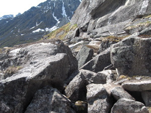
 And many, I think, relish the hardships. Besides the mud, much of the trail disappears and reappears along the stretch of boulders you go through.
 However, because of the poor quality and maintenance of the trails, they get really muddy. Because they go up fairly steeply, they are very slippery. So people begin to walk off the trail creating new trails. Or they make shortcuts across the switchbacks, leading to places for rainwater to start worse erosion.


