Monday, September 23, 2013

Hell's Gate Tram - Hiking Down - Open Coal Trains


"Originally perceived as a major obstacle to travel between the Coast and the Interior, the Canyon over time became the principal route for commercial and passenger traffic.  Originally dangerous in the extreme, travel through the Canyon was always a formidable prospect, although today's vastly-improved modern highway does not hint at the once terrifying and difficult journey that clung to the mountain's walls as if by sheer nerve.  Simon Fraser's journals speak of having to traverse sections of the canyon by a series of precipitous ladders and rock-climbs, and although several generations of road-builders had a crack at it (from 1859 onwards), the route remained a dizzying cliff-hanger until major highway improvements began in the later 1950s."

Before we got out of the canyon, we  stopped at Hell's Gate tram parking lot for lunch.  We made some sandwiches and checked out the tram office.  $21 to ride the tram - 1000 feet down into the gorge and their tourist shops and restaurant.  Not for us.

(I thought I'd written on this before and I do have a post that focuses on how the original work in the canyon resulted in disaster for the salmon and the people who lived off the salmon.)  

Another couple talked to the guy at the tram and when they passed us said there was a trail to the bottom that only took half an hour.

We walked along a path, under the red bridge to the other parking lot and then came to another parking lot.  The trail was wide enough for a vehicle, but gated off.  And it was a beautiful forest.  The sign said 1 km - a little more than half a mile. 

 This mourning cloak butterfly was flying and resting near me so, I thought I should get a picture. 


It was was definitely down hill, but not bad.  At the bottom there were no trespassing signs and danger signs, but I figured if they guy had said you could walk down, I'd do it.


From the bottom, here's one of the trams.  It took about 15 minutes to get down and 20 to get back up.  But you do have to cross the railroad tracks and given the long trains we saw, you could get stuck.  I decided I didn't need the touristy stuff - the tram website says:

Facilities include:  Simon’s Cafe, Gold Panner Gift Shop, Education Centre, Fudge Factory, Gold Panning, Simon’s Wall, Observation Decks & Suspension Bridge.
 I was more interested in the walk and the gorge.  The water must have been low because it wasn't the rushing torrent I was expecting.

Shortly after I got back over the tracks and started my return trip to the highway, this coal train came by.  I was amazed to see the coal transported in open cars.  Was there something I was missing?  I didn't see any coal dust going into the air, but it was a warm, windless day.

So I checked. 


 Coal Train Facts, a website opposed to shipping coal from Montana to Cherry Point in northwest Washington for shipment to China outlines coal dust concerns:

Because most coal trains are uncovered, they produce significant amounts of coal dust in the course of transporting the coal from one place to another. According to BNSF research, 500 pounds to a ton of of coal can escape a single loaded car. Coal dust is regarded as a nuisance, as the dust can damage the ballast and, the railway claims, cause derailments.  BNSF asks that shippers pay for dust mitigation; shippers typically balk at paying. The Puget Sound coast line is notoriously rainy and windy; it is unclear as to how effective surfactants might be at containing the pulverized coal in adverse weather. There seem to be no guarantees that dust would successfully be controlled en route from the mines to the port. 
Dust is also generated at the terminal site, as bulldozers continually shift and rotate the ground-up coal. Constant turnover is required to both keep the coal in one area, and also to prevent spontaneous combustion.  Wind and moisture can agitate the combustive properties of coal. The potential adverse effects of coal dust on adjacent sites was a factor in the Port of Vancouver rejecting a proposal to export coal from a new export site there. The dust is notoriously difficult to control, and has proven to be a concern for residents close to Westshore, the coal port in BC. The coal at the proposed GPT terminal will be stored in open heaps on 80-105 acres located in proximity to the Cherry Point Aquatic Reserve. Cherry Point can be buffeted by high winds, winter conditions often see wind gusts in the 60-70 knot range. It seems likely that the wind will agitate the heaped, pulverized coal. 
The leaching of toxic heavy metals from coal ash into water supplies is a proven problem. Exposure to arsenic, cadmium, barium, chromium, selenium, lead and mercury can cause any number of health problems, including cancers and neurological diseases.  It is unknown if and to what extent these heavy metals might leach out from the coal and/or fugitive coal dust, from the train cars and at the terminal storage site, into local water supplies and into the marine environment. There are potential implications for the safety of the water we drink and the seafood we eat.
- See more at: http://www.coaltrainfacts.org/key-facts#sthash.kjyRH0uH.dpuf
The pro coal side, represented by Freedom Works in this case, tends to pick at the details, but essentially seems to acknowledge the problems - just not where the environmentalists say.  Here's an example (which doesn't refer to the quote above): 
That passage from the white paper is instructive for a couple of other reasons. The author cites derailments and the average amount of dust lost from coal cars, but he does not say WHERE these things occur. It turns out that the two derailments in 2005 happened on the short Powder River Basin line, not far from the train's point of origin. It was attributed to coal dust fouling the ballast used as a bed for the rails. Regarding the amount of coal dust lost, what the enviros never tell you is WHERE that dust is lost. It doesn't take much effort to realize that most of the dust will be lost at the point of origin - near the mine where the cars are loaded. The further the train travels away from the loading point, the more the load will settle, meaning that less dust is going to blow away. The environmental extremist way of explaining this is to say, "It is unclear how much coal dust might escape in the Pacific Northwest ..."

Juan did a much better job of getting pictures of the spot than I did.  Check his site.

Sunday, September 22, 2013

Clinton, BC - 150 Years Old

"Staying true to its rawhide roots today, Clinton’s Main Street still exudes a Wild West flavour, with many of the buildings boasting their original storefronts, restored to retain the western atmosphere and character." [from Visit British Columbia]


Maybe that's what lured us, after getting gas, to just park on the main street - Cariboo Highway - and walk around.  And then pull out my camera.


After the discovery of gold in the Cariboo, Royal Engineers were commissioned to build a road through the Fraser Canyon to the Cariboo to join the already existing wagon road from Lillooet to 47 Mile. The junction was 47 miles from Lillooet and thus 47 Mile was the name used until 1863, when 47 Mile officially became Clinton. The community also boasts of hosting one of British Columbia's oldest continuously running events, the "Clinton Annual Ball," held in May of each year.  [BCAdventure.com]


"Once a busy junction on the wagon road leading to the Cariboo and Barkerville gold fields, Clinton was originally known as The Junction, and Cut Off Valley, before being renamed in 1863, honouring the Colonial Secretary, Henry Pelham Clinton, the 5th Duke of Newcastle." [Visit British Columbia]

The sign in front of this old Church says
"High Bar First Nations."

I looked hard to find more than business info on the High Bar and eventually went back to the Wikipedia entry:


"The High Bar First Nation is a First Nations government of the Secwepemc (Shuswap) Nation, located in the Fraser Canyon-Cariboo region of the Central Interior of the Canadian province of British Columbia. It was created when the government of the then-Colony of British Columbia established an Indian Reserve system in the 1860s. It is one of three Secwepemc bands that is not a member of either the Shuswap Nation Tribal Council or the Northern Shuswap Tribal Council. The High Bar people are also partly Tsilhqot'in and have links with some Chilcotin First Nations.
In the Chilcotin language, the High Bar people are the Llenlleney'ten. The Secwepemc in the Fraser Canyon and on the Chilcotin Plateau are also known as the Canyon Shuswap and have traditionally had close ties with the Tsilhqot'in people."
The High Bar First Nations Facebook page offers a little more information.

This painting on the builiding looks a lot like Southeast Alaska art work.  I don't know the relationship between the High Bar and Tlingit/Haida peoples.  


Our modern world changes how we know and what we can know easily.  Just googling the address I found the listing for this house.  They want $215,000 (that's Canadian, but pretty close to US.)


We also learned about Clinton the old fashioned way.  We talked to Bruce who owns this second hand store.  Even after figuring out we weren't planning on buying anything, he was friendly and talkative.  He was less sanguine about Clinton suggesting it was more like a town in a Stephen King novel and that the Many Good Things sign was an allusion to King. (I couldn't find the book it comes from, but I did learn that a lot of people use the phrase "I've heard many good things" when they post about Stephen King.)  He's also a former figure skating coach and an artist. 


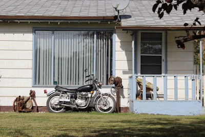
I didn't check online for the price of this motorcycle, but if someone is really interested, email me.  The phone number is legible on the original.


Google came up blank on Mr. and Mrs. Joe Dealz.  I think it's a great title for a book. 


The museum.


I do appreciate people who make the extra effort to do things like design their fence around a rock. 

An historical cairn in Clinton marks the junction of two routes to the Cariboo gold mines; The original 1859 Cariboo Trail from Lillooet, and the Cariboo Road through the Fraser Canyon, built in 1863 by the Royal Engineers.
Situated halfway to these gold fields, Clinton was an ideal place for weary travellers suffering from gold fever to stop for a rest, food, entertainment, and even encouragement. Clinton grew with the demand for these services. [from Visit British Columbia]


I guess this is the 150th Anniversary of this town becoming Clinton.  Travel British Columbia says 793 people live in Clinton.  City Data says 636 in 2011.  They also had a map.   Clinton's the blue spot in the upper right.  Click to make it clearer and bigger.


Saturday, September 21, 2013

Anchorage to Seattle Day 6: Lac La Hache to Bainbridge Island


He was comfortably resting by the porch when I showed up, then ambled up to the picket fence where he just wanted to be petted and get some attention.  This was on the main street of Clinton, BC, which happens to be the highway.  We stopped here for gas and it seemed so much less spoiled by strip malls and chain stores that we walked around.  I'm going to do a whole photo portrait of Clinton.  This is just a preview.


We began after breakfast at the Provincial campground at Lac La Hache.  We're clearly getting into civilizations.  The campground bathrooms had flush toilets and and granite counter tops.

Compared to three years ago, Thursday (Day 5) and Friday (Day 6) went much faster because there was less traffic and almost no interruption due to construction.  And this last day was mostly sunny and warm - about 20˚C I would guess.


The landscape was getting more arid.  We were passing what almost looked like semi-desert, with these bunches of yellow flowers topping gray-green foliage.  I don't know what they are, but they were everywhere. 


And then we got to the Fraser River and Canyon.  We followed this passage for several hours.  The train seemed endless and was there whenever we looked.  One side of the canyon was dry and the other side lush with evergreens. 


At this point we're closer to the water.  We couldn't see the end of the train in either direction. 


And there were lots of tunnels along this route.  Most, so well lit up, I didn't need to take off my sunglasses. 

Along this route we got to Devil's Gate, where we had lunch and took a short hike in the beautiful weather, which I'll do a separate post on. 

Eventually we got out of the canyon and onto a freeway - Canada Highway 1.  At Abbotsford we got off the freeway and headed south a couple of miles to the US border.  I just checked now and found there's a cam at the border you can check online to see how crowded the customs line is. 


Crossing into the US here was easier than when we crossed into Canada in the relatively remote Beaver Creek crossing into the Yukon.  Then we were back on small rural road heading west and then south into Bellingham where we caught the I-5 to Seattle.  It was here, in the middle of five lanes of southbound traffic, as it was getting dark, that it started pouring.  But by the time we got to the ferry terminal, the rain had ended.  Below is a view of some of the Seattle skyline as the ferry took off for Bainbridge Island. 


This is a great road trip and I wish we had more time to poke around, hike, and just enjoy the beautiful country.  Driving through Canada does require us to think differently - the signs are in kilometers and the gas comes in litres.  The dollars are pretty close to equal so that's relatively easy.  It's generally good when the things we take for granted get skewed a bit and we have to think about them and realize our world is not the only possible world.  (Just not too much at once.)


Our grand daughter has grown a lot, is crawling and pulling herself up to a standing position, and picking up bits of food and stuffing them into her mouth.  She's also a lot more cautious about straying far from Mama. 

Redistricting Board Challengers Claim Political Gerrymandering In Court Filing

[Saturday 9/21/13:  I thought this got posted the other day, but apparently not.  I've taken advantage of the delay to clean it up a bit.]

I posted the September 13, 2013 Riley court filings without really having time to read them, but while J drove I finished them.  These new filings add details to the original filing that challenged the latest Redistricting Proclamation Plan. 

I’m typing in the passenger seat as we drive through spectacular fall colors near Whitehorse,  so this won’t go into too much depth, you can see the whole complaint on my earlier post and find the sections you want to read further.  I’ll put up several posts, I hope, when we get to Whitehorse.

Here’s an outline of the filing with some comments. 

I.  Summary Judgment Standard

II.  Compactness Claims
House districts 3, 5 - Fairbanks; 9, 12 - Matsu; and 32 Kenai.)  By breaking the Borough boundaries, they argue they also make the districts less  compact.  As proof they offer options submitted by other private parties.  

III.  Unnecessary splitting in the Matsu and Kenai Districts
There are challenges to some Fairbanks and Matsu and Kenai house districts because they are unnecessarily joined with populations outside of the boroughs they’re in.  These splits, besides violating the standard to keep political boundaries as intact as possible, also, they argue, results in the compactness problems they first mentioned.

They also get into discussion of deviation inconsistencies.  They offer options that were before the Board, even adopted as draft options by the Board, that they claim take care of these issues in a way that meets the Alaska constitutional standards better.  And they find fault with the Board’s articulated reasons for what they did as either inconsistent or non-existent. (I’m simplifying this so I can get it done by the time we get to Whitehorse.  [UPDATE 9/21/13:  I thought I'd posted this from Whitehorse, but didn't so I'm cleaning up and adding.  Probably a good thing it didn't go up before.]

You can read the original document HERE.


The Gerrymandering Claims

But when you read further down, there is a quote from Board member Bob Brodie talking to the Riley attorney, Michael Walleri.

III. [This is III in the original but should be IV] Avoidable Deviation Variance in SD 5 and 6

 I posted a detailed explanation of the deviation issues in an earlier post.  The numbers aren’t all that significant by themselves, but when you combine them with the compactness issues of the house districts involved - and for me the contiguity issue for HD 5 - and the splitting of UAF campus, they all seem to point toward something fishy. 

They argue here also argue that the Board really didn’t consider deviation among Senate Districts at all.  This is the first time they quote Board member Brodie. 
“Mr. Brodie admitted that the Board never considered or otherwise attempted to reduce deviations between Senate Districts.”
A little later they write:
“More interestingly, Mr. Brodie urged his fellow board members to deny the lower deviation configuration [switching housed districts in senate districts A and B] on political grounds:  i.e. to deny the Riley plaintiffs a perceived political advantage.” (p. 36)
This leads to footnote 94:
“94.  Boardmember Bob Brodie indicated that “he (referencing the undersigned [Riley plaintiffs’ attorney Walleri]) just looked at the political makeup of the senate districts where his clients live and now he wants to change it to give them (Mr. Riley and Mr. Dearborn) the biggest advantage they possibly can without any altruistic feelings of the state redistricting process.  . . Of course, Dr. Handley [the voting rights consultant] identified the residents of Ester/Goldstream as Democratic leaning voters, and Board counsel has often stated that the Riley Plaintiffs were stalking horses for the Democratic party.  Of course, the Board denies any motivation to benefit the Republican party with the resulting district configuration, however, the statements by Mr. Brodie indicate that he believed that the senate pairing benefited the political interests of the political party that the Board associated with the Riley Plaintiffs, and an intention to ignore deviation considerations in furtherance of an intention to deny any such advantage to the Riley Plaintiffs and their Democratic associates.  The motivations present factual issues in dispute that will require trial.” (p. 36)

We’re getting close to Whitehorse, so let me cut to the chase.

I’ve heard on various occasions that gerrymandering is illegal, but no one has every won a case against a redistricting board based on gerrymandering.  It’s too hard to prove the intentions of the Board members.  So, the proxy for this is whether they stick to the procedural rules while doing their work and whether they balance the different standards - compactness, one-person-one vote, contiguity, socio-economic integration, etc. - better than any alternative plans others offered.

The Riley Plaintiffs are arguing that they didn’t.  Here they don’t ask the Court to find gerrymandering - though they point it out - but rather find that districts are not as compact and deviations aren’t as low as they could have been.  That’s all I can do at this point. 

This part begins around page 35 of the document.

[Saturday update:  I'm adding on here since this didn't get posted earlier.]

Rejected Settlement Offer

In this section on  "Avoidable Deviation Variance in SD 5 and 6" the filing also reveals that the plaintiffs
"made an offer to settle the present litigation if the Board would swap the Dist. 4-B to 4-C, and to change Dist. 6-C to Dis. 6-B in the proposed "Concept Plan" under consideration by the Board."
This would swap two house seats and rearrange Senate Districts B and C to a configuration that, in my mind, makes much more sense.  The new districts would have much more contiguous house districts and the University of Alaska Fairbanks wouldn't be split and the deviations would be lower.

The Plaintiffs' complaint is not so much that the offer was rejected, but how it was rejected.  It was originally rejected without being mentioned in public meetings .  They also claim that the Board's attorney said that he had conveyed the message to the Chair who had discussed the issue one-on-one with each Board member and they had decided to reject it.

Three or more Board members are not allowed, by law, to discuss Board issues except in public meetings.  The plaintiffs argue that
"such a procedure --- often called daisy-chain communication - - - violated the state Open Meeting Act, and that the Board should cure the violation by meeting and placing the matter on the record.  Board counsel requested that the offer be made in writing, and on July 17, 2013, the undersigned [plaintiffs attorney Michael Walleri] provided the offer in writing which was included in the Board record."
It subsequently did go on the record on July 18.  So, presumably, the Board cured the violation, but the plaintiffs write
"In rejecting the offer, Mr. Brodie admitted that the Board never considered the deviations between Senate districts as a relevant factor."

 IV.  [Again, this should be V]  TRUNCATION

I've already done a long post about truncation related to this 2013 "Final" Proclamation Plan

The filing looks at the prior case law on truncation and then what's happened with truncation with this current Board's several Proclamation Plans.  And finally in this cycle.

The focus here is the change from the very high level of same constituency (I had put it at 10%, but the filing says 13%) in the previous round to 25% this last round which allowed Sen. Coghill to escape truncation.

The Riley filing goes on to point out that while SD P [Democratic Sen. Egan in Juneau] with an 86.7% same constituency was not truncated,
"Oddly, the Board truncated SD B (City of Fairbanks) [which had been held by Democratic Sen. Paskvan] despite the fact that SD B had changed less than SD P"
They also point out that in 2012
"As a result [of using 13% as the truncation cutoff] all seats with less than 85% of the population of the former district were truncated, including two (2) seats over 75%:  i.e. SD L (77.7%) SD T (78.1%)."
 As I understand the term truncation, it means cutting short those seats that still would have two more years to serve in the next election.  This allows the electorate a say on who represents them.  After the board truncates seats with substantially new constituents, it has to re-stagger the seats so that only ten seats come up for election each election. 

Under that definition, the three seats the Riley document claims were truncated (SD B, SD L, and SD T) were NOT really truncated because their terms were up in 2012 anyway (as I read the admittedly confusing charts that assign two and four year terms.  I say confusing because tracking the changing seat numbers and incumbents over the various changes takes some effort.) 

However, the fact that all three had their next terms limited to two years probably is of relevance.  But then the whole way this Board did the truncation and assignment of two and four year terms was significantly less straightforward and rational than the previous Board as I demonstrated in this previous post comparing how the 2000 Board and the 2011 Board went about truncating districts.

I do think it is significant that in the previous round, the Board made the cutoff for truncation about 87% and shortened the next terms of three Democratic Senators to two years, even though their districts were over 75% the same, while this time making 75% the cutoff point for truncation allowing a Republican senator to escape truncation.  It is also significant that this is the very district in which the plaintiffs in this case reside. 


V.  SENATE DISTRICT B AND UAF

Here, the Riley Plaintiff filing challenges the compactness of Senate District B  (the two house districts (3 and 4) it joins are contiguous at one tiny point, then they each go off in totally different directions).  Both districts are much more contiguous with the districts the plaintiffs proposed switching to. And they also point out that the University of Alaska Fairbanks is unnecessarily split into two different Senate seats and the deviations are lower.  They also imply that this was in part done in retaliation against the plaintiffs who live in this district.
"As noted in Mr. Bordie's [sic] comments at the July 17th hearing, the Board was fully aware that the configuration was adverse to the interest of the Ester/Goldstream area [where the plaintiffs live].  The totality of the evidence - -  meandering bizarre shaped district, mixing different communities of interest, and a Board record that clearly demonstrates conflicting political inclinations - - - demonstrates a strong inference of discrimination."

Is everyone totally confused now? Posts with pictures of trees was a lot easier to read (and write.) I hope some of this makes sense and helps a few people understand a little better what is before the court.  Perhaps reading this post will make reading the whole court filing easier.  Although it is 51 pages, the print is big, the line spacing is big, and there are a bunch of maps, so it isn't all that long.  Here's the link to the original filing again.

Friday, September 20, 2013

Anchorage To Seattle Day 5: Hazelton to Lac La Hache


Day 4 got us from the northern end of the Cassiar Highway all the way down to where it connected to the Yellowhead Highway (37).   This is what it looked like Thursday morning.


We'd begun at the Seeley Lake campground which was a lovely spot with nice campsites, but right up against the highway with lots of trucks going by all night.

Seeley Lake


I put up a picture of the Skeena Bakery, a few miles from the campground, at the end of yesterday's post.

Once off the Cassiar, we're out of the wilder country and coming into more civilized territory.  There are still lots of trees, but the forest areas are broken up by lots of small towns and farmland.  We saw lots of timber trucks and here and there stacks of dead trees.


It's hard driving and taking pictures so this isn't too representative of the land we passed through.  We stopped for lunch at Burns Lake.

Burns Lake


Reading the local paper in the New Leaf Cafe, we saw that there's lots of local opposition to the Enbridge pipeline that would take oil to the British Columbia coast.  


Trips like these run well with audio books.  We'd listened to Eowyn Ivey's The Snow Child out of Alaska and into the Yukon and Cassiar.  I hate to be churlish - anyone who actually writes a whole novel has my admiration.  And an Alaskan first novelist who wins international awards is something I want to support.  But I felt somewhat like this commenter at the Guardian:

"The descriptions of landscape are good.
I liked the way the women in the book were described which was not stereotypical.
But the actual story became boring because it was so obvious what was going to happen at each stage. Also the interpretation that wove myth and reality was often clumsy. Needed more hard thought how to make it work. It was a good concept but the author needed a bit of help and editing support."
The blending of supernatural and real is tricky.  And as the next book began - Walter Mosley's The Gift of Fire - I thought I had an example of an experienced writer doing this much better.  And that was true at first.  He didn't fuss trying to explain things - he had confidence that the reader would figure it out.  And it's much, much shorter.  But it too seemed to struggle to hold together what it started.  Both books though had lots of good insights into human beings and how they tick.  And a number of reviewers had much more positive things to say.  For many Alaska was an exotic setting.  For me it was home, though nearly a century ago and in harder times.

I realized yesterday that many readers have no idea where the places I've been writing about on this trip are.  The map below started in The Milepost and I've added white stars to mark Day 4 and bluish ones for Day 5.  Day 4 began about 60 miles south of the junction between the Alaskan Highway (also known as the Alcan) and the Cassiar Highway. Day 5 has us rejoining the red line from the Alcan at Prince George.


I saved it pretty big and if you click on it, you can see it a little better.


We were trying to make it to Lac La Hache to have dinner at the Edelweis restaurant which I've written about in a previous trip.  But when we pulled up at 7:30pm, the closed sign was already up.  But we did have this great sky to console us.  And a full moon came up a little later.  And it felt much warmer than it had been.   

We made it to Seattle this evening and I'll do more on today's trip later.

Thursday, September 19, 2013

Anchorage To Seattle Day 3[4]: Cassiar Highway - Boya Lake to Yellowhead Highway


[Update:  Whoops, I lost a day there.  This is really Day 4] Boya Lake campground is 60 miles onto the Cassiar Highway junction with the Alaska Highway.


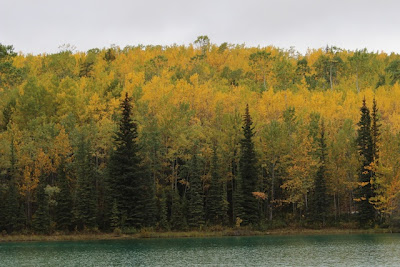
 From Whitehorse south the fall was not as well advanced as it had been the first two days and there are a lot more still green trees.  But as we walked briefly along the shore of Boya Lake there was a fair amount of color


We had clouds, some rain, sunshine alternating all day long.  The road is completely paved now, a big difference from when we first drove down the Cassiar and it was mostly dirt and mud.  More traffic too now.  


And there is still construction, but we didn't have much delay yesterday. 


We had a sunny lunch break with some heated up spaghetti.


It was raining ahead, and soon we were in it.  Then it was over again. 

We saw eight black bear today in four encounters - one was a mother with three cubs.  But none were conducive to photography. 


There putting in these huge power poles along the southern part of the road.  Everyone should have access to electricity, but these are so obtrusive along the highway, such an assault on the natural landscape. 


We got down to the Yellowhead Highway (Between Prince George and Prince Rupert) and camped at Seeley Lake and did a short walk along the lake at dusk.

The campsite is right along the highway and pretty noisy, but I slept well anyway.

It's great to be out in this beautiful country and away from everyday things.  We listened to The Snow Child on CD which was good for driving in the north, but it did go on and on and on.


Here's a glimpse into Day 4:  We're at the Skeena Bakery in Hazelton, a short distance from the campground.  We discovered this on our trip this way three years ago.  Like Bridges Cafe in Whitehorse, they have a public service function too - here they work with special needs adults.