Showing posts with label hiking. Show all posts

Sunday, April 28, 2019

Too Nice To Stay In - Short McHugh Creek Hike And Potter Marsh Swan


The Jacob's Ladder was already blooming on the south facing slopes.  


Looking across the inlet, there was something fuzzy in that avalanche chute - blowing snow?  Or water falling already?  


Several posts in draft but needing more attention.  Lakshmi Sign was the keynote speaker at the Alaska Press Club conference yesterday and Brett Wilkison's  presentation on lessons learned from the Santa Rosa Press-Democrat's Pulitzer Prize winning coverage of the Santa Rosa fire and its aftermath had a lot of interesting bits.  Stay tuned.  

Thursday, September 13, 2018

Great Day For A Long Ride To A Short Hike - Bodenburg Butte

With all this sunny dry weather I've been wanting to get out in the woods, but there were meetings and various chores that got in the way.  But today it was nice once again and we had nothing to interfere.

I wanted to go to Hatcher Pass, but talked myself into Bodenburg Butte - a hike I'd never been on.  All these years, it just never was a destination.  Hatcher Pass seemed like a more spectacular location.  I heard the views were good, and it's only a 3 mile round trip - though half of the hike is up.  So we got onto the Old Glenn Highway just before the Knik River.   Haven't been on that road for a long time either.

Even though I'd read the directions saying to go past Bodenburg Loop as we approached from the south, I turned there anyway.  Oh well.  This got to the south trail that was not recommended.  But since I don't think I've ever been on the loop, it was good to see.

Here's the Butte from the south.


A sign about a third of the way up - where we stopped to eat lunch - explained the geology:


I guess reading this is a bit of an eye exercise.  It says:
"Bodenburg Butte is an example of a Roche Moutennee, a French word describing a rock formation created by a passing glacier.  During the last ice age, the Knik Glacier moved through this valley, shaping the landscape that you see today.  As the frozen river of ice flowed through the area, it carried away tons of softer rock, carving out a valley.  The knob of much harder bedrock that was unmoved by the glacier's advance is what we know today as the Butte." 


This is looking up from the lunch spot.  I was trying to figure out where the trail was when I heard a familiar, but bizarre croaking/cackling sound.  There were lots of trees above, but for a moment I could see a flock of Sandhill cranes flying way above.

Soon I saw our way up.   First wooden stairs.


Then they changed to wood with earth packed in and  cable replaced the wooden handrails


This really is the most unAlaskan hike I can think of in Alaska.  It's a hump not a mountain.  It's in a rural area with farms and houses all around it.  And it has stairs.  A sign at the top said there are 505 steps.  That's not counting the unstaired trail.  But my knees said thank you.


And soon we were at the top and there were wonderful views in every direction.   Here's looking south.  I was near that white roof in the lower right when I took the top picture of the whole Butte from below.  There's even a reindeer farm down there.


And to the east is the Knik Glacier and the braided Knik River that flows from it.


And then I saw something moving down below.  I think it's a juvenile bald eagle - the head and tail feathers are white yet.


And it did lazy circles up on the warm, calm air.


Until it was above me.  


Needless to say, the trip down took much less time than going up.  Altogether, with a lazy lunch and some time enjoying the views on top, it was about two hours.  I'm guessing this is Palmer and Wasilla's version of Flattop.  But it's a lot easier to get great views.  As you can see it was a mostly sunny day, but the air wasn't particularly clear and sharp.  


Wednesday, July 18, 2018

A Story Recalling Meandering, And the Flaneur


This all started out fairly early Tuesday as I went along with my daughter and granddaughter to watch the little one bounce for a couple of hours.

But to be an observer I had to fill out an online waiver.  I understand.  Trampolining can be dangerous.  Someone I know broke his neck at a place like this (maybe even this one.)  He was lucky and after painful, scary months and months we was pretty much back to normal.  But there's a lot of liability with a place like this.

But I was only there to observe.  And the online form there asks for dribbles of information.  A paper form you can see what they're asking for all at once and decide if you want to share it all.  So I asked - how much more are they going to ask?
She didn't really hear me and said, "everyone has to fill one out."
Me;  "But I'm only observing."
She:  "Observers can be injured too."  [Isn't this the time people should leave?]
She:  "They don't use the information."
Me:  "Then why are they collecting it?  [I was being snarky.  I understood what she meant - that it's only in case of an accident.]  But even if they don't, someone can hack the computers."

Out of principle - that way too much information is collected about all of us - I decided I would not stay.  Besides I really didn't want to see my granddaughter risking her neck.

So I decided instead to walk around this South Anchorage neighborhood - between Old and New Seward Highways -

I'd only driven by on occasion, but had never really looked at carefully.  It's a funky sort of place with all sorts of housing and yards.

[I'd note the meandering reference in the title beckons back to a long ago post about meandering that comes from Charles Dickens opening to David Copperfield.  It's also a good description of how I often write.  The Flaneur references a post I did about a book by that title that I read while we were in Paris and is about just wandering with no goal through neighborhoods.]


This sign below the mailboxes - click to enlarge so you can read it - was the first that suggested people weren't cleaning up after their dogs.  "Attention Humans:  Please Pick Up After Your Dogs, Thank you."  Then it addresses the dogs.


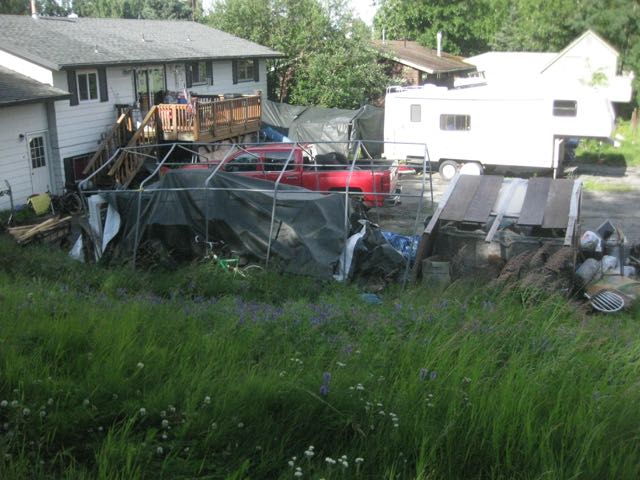
There were big houses with big yards and gardens.  This one was next to a lot with a  double wide trailer.


Here's another inviting tree filled green yard that reminded me more of the mid-west than Anchorage.


Near another lot that reminded me of old Spenard.


And there were lots of trees and green.


But there also were dozens of zero lot line condos (presumably) scattered in the neighborhood.  Some had more green space around them than others.


If you look closely, Spyglass Hill is a private street, so I didn't go there.  As I wandered around I only saw one other pedestrian.  A woman with a walker and a tiny dog that took his job as her protector seriously.  She was laboring up the steepest hill in the neighborhood.

But I did wonder whether people might not be alerting NextDoor  (I think you may have to sign in to get to the link.) or the police if I had been black or worse dressed than I was.    Especially since I was taking pictures of people's property.

After wandering streets and alleys a while, I got to a bike path that started green and shady, but after about a quarter mile I ended in an industrial area.


It came out near a school district complex.


Past the student nutrition area was a nursery I had never seen before.


I wandered around outside, excited by this find.  (It turned out everything was outside.) But when I saw this item, I realized why all the rocks in my garden were picked up along highway construction sites.  A cubic yard of 'angular boulders"  was $195.  Gravel was only $95.  A cubic yard of gravel is a lot of gravel, but I suspect a cubic yard of the boulders has lots of empty spaces.


There were also also lots of different kinds of trees at serious prices as well.  I quickly deduced this was more for professional landscapers, but homeowners can buy here as well.


Lots of ways to spend your money on things I didn't know I needed.


This natural stone table (and stools) was only  $2786.


Rows of critters of all sorts.


I can see possible uses for these planters.


This dragon was certainly the most interesting item. I didn't check the price tag.


It's interesting to know this is in town in case I ever need something like this.


But then I made my way back out and got to a small strip mall.  I don't know what they do at this place, but it doesn't sound like a place I would ever want to need.

Then as I got back to Old Seward Highway. . .


First I saw the cross. Then I saw the sign.


I checked on line to find out who Justin was.


From his ADN obituary:
Justin Grey Ashley was killed in a tragic motorcycle accident Monday evening, July 8,
2013.
Justin was born on July 9, 1992 in Fremont, California to Brian and Charise Ashley. He grew up playing soccer and baseball and loved to ride his bike with his two childhood friends, Josh and Alex. He was a Cub Scout and bridged over to become a Boy Scout.
Justin moved to Alaska with his family when he was 12. He quickly made friends. . .
So yesterday was just a few days past the fifth anniversary of his death.   My sympathies to his family.  My brother was two years older when he died, so I have a sense of their terrible loss.


As I passed Judy's Cafe it reminded me of the place where they charged me an extra $.50 to NOT have cheese in my omelette.  I checked with K who was with me at the time and he said it was not Judy's.


I was getting close to full circle back to pick up the jumpers, when this car with a Begich sign pulled up onto the sidewalk in front of me.  He got out and struggled to get some sandbags that
were at the curb into the car.  I did mention to him that it didn't reflect well on his candidate to be driving on the sidewalk, though parking in the street wasn't a good idea either and he clearly couldn't move the sandbags very far.


At a dog kennel nearby, a woman pulled up and parked right in front of a No Parking sign and went in.


Almost back and I passed what looked like a single family home, but it had four mailboxes in front of it.


I got back just in time to get into the car and open the newspaper before my bouncing family members came out.  I'd had my adventure too.

I thought of the year we lived in Hong Kong when we decided that we could take urban hikes - and just walk three or more miles as we would in a more wild setting.  And there we could catch public transportation home from wherever we ended up.

Sunday, June 10, 2018

Getting Out: Prospect Heights Trail Toward Wolverine Peak

Easy access to Alaska is the reason I live here.  But we've been spending a lot of time getting the house back to 'nice' - freshly painted, new front steps that aren't cracking and threatening come apart, and shedding stuff that's collected over the years.  Mostly we're down to stuff that has sentimental value.  Things that are connected to people we like or remind of us when we were one place or another.

But it was just too nice today and I'm determined to get my money's worth for the State Parks Pass on both cars this year - that means about 20 trips would cover the $5 parking fee at most state park parking lots.  

So even though it's Sunday, we headed for Prospect Heights trailhead to go up the Wolverine Peak trail.  I wanted to get to the rock just above treeline that's been a landmark in family pictures since we started hiking Anchorage - our first full summer 1978.   
The parking lot, which is more than double the size since we got here, was crowded, but with a few spaces when we got there about 12:30pm.  


This is the south fork of Campbell Creek from the bridge.  This creek then wanders through the Campbell Tract, south of Tudor to Campbell Creek Park, then on past the Arctic Roadrunner to Taku Creek and on west to the Inlet.  And it wanders through various posts in this blog as I post pictures from the trail along the creek.  But it's much wilder here on the mountain headed down to flatter terrain.

J stopped at the fork in the trail where you decide between Near Peak and Wolverine Peak.  I wanted to get up to "the rock."  I'm guessing the rock is roughly 3 miles in, from the fork, starting to get much steeper.


My sense is that this rock used to be up above all the brushy area, pretty much out on its own in the tundra.  But in this picture you can see the brushy stuff going well past the rock on the left.  When we got home I went looking through early photo albums looking for this same picture.  I'm sure there are a number of them somewhere.  What I found was a picture of the rock, May 1979 looking up toward Wolverine Peak.

It's pretty much tundra around the rock, though the right side (left side on the previous picture) is cut off.  I did also take a picture today looking up, but from from the rock or a little above it.


I used a wide angle lens for the picture today, so it look a bit more stretched out, but it's essentially the same picture (but without the rock).  Trees and brush have crept up the mountain as the climate has warmed since the 1979 picture.  I can't say when in May the top picture was, but things hadn't greened yet and there was a lot more snow.  The little guy is in shorts, so I'm guessing it was later in May rather than earlier.  Some now used to last most, if not all the summer, on the mountains.  And we used to hike through snow patches on the way up to Wolverine Peak.  Here it is early June - and we had a relative late (for recent years) spring - and there's not much snow left.


And the Labrador tea flowers were beginning to bloom.

Hiking uses different muscles than biking.  I can feel them.  I need to do this much more often.


Monday, April 16, 2018

Turnagain Arm Mudflats - A Favorite Beach Walk Has Fewer Rocks, More Mud


There are lots of spots along Turnagain Arm to stop and explore.  On the east side (away from the water) they tend to go up pretty steeply and that's less and less appealing as we get older.  On the west side are favorite spot is a small parking spot near Indian where the bike trail starts.  But where you can get over a small chainlink fence and then over the railroad tracks down to a rocky beach.

Though we discovered yesterday that the rocky part is much more limited than it used to be  It's mostly mudflats now.


Yesterday there was only a thin area that was rocky, right along the where you climb down the boulders from the railroad tracks.  Then it turned quickly to mudflats.


Here's a picture from September 2012 at this same beach.  While it's not the same exact spot, you can see the same mountains in the background.  You can't even see the rocky slope on the left where the railroad tracks are.   The area between the railroad tracks and the mudflats was much greater.


But let's enjoy the amazing textures of the mudflats.


This one is from the road.  I can't remember such a low tide where I couldn't see any water except for in the deeper channels.


As we got over the railroad tracks we found a couple and their dog enjoying a picnic overlooking Turnagain Arm.  It was warmish (high 50s F) and no wind at all.)


And here we are on the railroad tracks (looking south) as we head back.