[UPDATE 2/20/23 - Now available in Anchorage at Mosquito books and Barnes and Noble]
Sharman Haley's book, Perspectives on Place: An Alaskan Explores the Pyrenees came out early December. It's an account of her walking tour on the the Haute Route, some 800 kilometers (500 miles) through the Pyrenees of Northern Spain. Sharman is a retired economist and sometimes that's reflected in the depth she explores things. But the beautiful water colors of her partner and travel companion Michael Samoya offer a refreshing respite from the more difficult passages. A good reflection of the hike itself I would imagine.
Sharman is a friend and was a colleague at the University of Alaska Anchorage. She let me view a prepublication copy in November and I've left a draft of this post languish since early December. My hope here is to give a sense of the book by using quotes that reflect the variety of topics she experienced on the trek. Not unlike many posts on this blog.
This book is probably most useful and interesting taken along when doing this hike through the Pyrenees. It's most basic organization is chronological, so hiking along the trail, one gets history, geography, natural history, along with descriptions of the trail and refuges along the way. So Sharman's details of the history of various locations would add richness to one's hike.
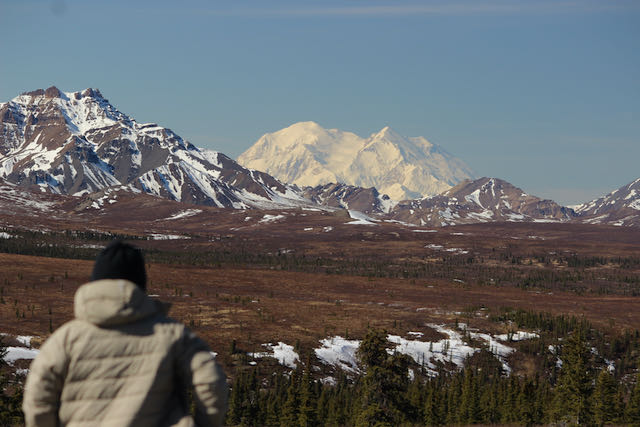
There's often a tendency to compare what you're seeing to what you know. It's how we expand our world view and gives us insights into our own homeland and assumptions. Sharman does this explicitly by adding an Alaska perspective to each chapter. For example, one chapter describes wars and treaties going back to the 1300s in Aragon. The matching Alaska history only goes back as far as the Russian invasion in the 1700s. While Haley acknowledges that Alaska Natives have been on the land for tens of thousands of years, she excuses leaving out any of that older history on the grounds that Native cultures were oral, so we don't know. However, there are archeological digs in Alaska that go back further than the Russians and matching them to archeological sites on the route might have been a better connection - perhaps comparing the archeology experiences of both places. Using invasions as the common thread seemed a stretch.
Here's a sampling of what you'll find on the pages of this unique book and, for me, engaging trip through the Pyrenees.
Useful travel advıce:
"Sleeping at the refuge with 30 other people side by side in two long
bunks was an experience. It was surprisingly comfortable and went remarkably
smoothly. Everyone was organized and quiet and respectful going to
bed and getting up. We were comfortable, yet didn’t sleep soundly.
The showers were great and the water was really, scaldingly hot! I
washed my hair. There was no gender separation in the bathrooms but of
course doors on the stalls. Our two showers, two red wines, veggie dinner,
two beds and breakfast cost 96€. The refuge administrator was a very
friendly, funny, multilingual middle-aged woman. In the winter she teaches
informatics. The guests are totally international from all over Europe. We
met no other Americans. Everyone uses English as their travel language." (98)
There's mountaineering history:
"Interest in mountaineering surged in the late 19th century. The
climbing and camping equipment was primitive by today’s standards:
Hemp ropes and iron crampons were heavy, and canvas tents were out of
the question. In the Pyrenees, early rock and ice climbers targeted the north faces of the peaks surrounding the Cirque de Gavarnie, mostly a day trip out of town. As their ambitions extended further, the need for overnight mountain lodging grew. Caves and shepherds’ huts were their earliest forms of shelter on multi-day climbs.
The first mountaineering club was formed in Gavarnie in 1864, named
the Société Ramond in honor of the illustrious Pyrenean naturalist Louis
Ramond de Carbonnières. The French Alpine Club (FAC) was founded in 1874 with the aim "to encourage and favor the knowledge of the mountain and its individual or collective frequentation in all seasons," including in its mission "the construction, improvement and maintenance of shelters, chalets, shelters and trails." The !rst mountain club in Spain, the Centre Excursionista de Catalunya (CEC), soon followed in 1876. These organizations, along with individual benefactors, launched the network of mountain refuges we enjoy today." (99-100)
Along with Michael's water colors.
Details on wildlife:
"My favorite insect of the whole trip was the burnet moth (Zygaena anthyllidis). While burnets are common throughout Europe, this particular species of burnet is unique to the higher elevations of the Pyrenees. The burnet is the most brilliantly colored moth I’ve ever seen: iridescent black, with big, red spots on the wings. Most moths are dull brown and only around at night to evade predators. The burnet doesn’t have to worry about that. The red spots tell potential predators that it is poisonous. The burnet carries hydrogen cyanide, both for protection and—get this—for mating. Sounds a little kinky, doesn’t it?" (p. 61)
We also learn about honey bees after Mike gets stung. After Sharman relates the physiology of the sting and the response in the body, we learn about the bees of the Pyrenees, and the history of domesticated honeybees in the region..
“Honey has been produced and consumed in France and Spain for
millennia. Cave paintings near Valencia, Spain, more than 8,000 years old depict men collecting honey. The Bible and the Koran praise the virtues of honey as a food of nutritional value. Spain is number one in the EU in the number of hives and sixth in honey production. Spain also produces more than half of the beeswax in Europe. I don’t know how many honey producers there are in the Pyrenees specically, but there are 27 in the Ariège region alone. You can find a lot of them online who advertise in glowing terms the high quality, "flavor and ecological properties of their mountain product and sell direct to the consumer.” (118)
Here's one of Mike's paintings showing the beehives along the path.
I learned a few words:
"Compounding the economic squeeze, the emigration of rural labor to industrial centers resulted in a shortage of shepherds to conduct the seasonal transhumance* of sheep." (126)
*"Transhumance: noun
the seasonal migration of livestock, and the people who tend them, between lowlands and adjacent mountains." (
from dictionary.com)
You can also tell that Haley was an economic policy analyst in a past life:
"More than two-thirds of the territory of Pallars Sobirà is under some
level of environmental protection. It also hosts seven ski resorts. In five
decades, the number of second homes in the region has mushroomed a
hundred-fold, from fewer than 25 to more than 2,500. While this boom in
the tourism economy has provided jobs, increased wages and helped to keep
some youth in the region, it has also increased property values and housing
costs for local residents. While the infrastructure has greatly improved,
temporary visitors and part-time residents do not enhance the social vitality
of the local communities. The transition also marks a decline in local
control, as more and more of the land use policies are defined by higher
levels of government and more and more of the businesses are owned by
nonlocal corporations." p. 127
Interview with Jan, a German hang glider about why he was on the trail, people he'd met, and a link to this video :
https://www.youtube.com/watch?v=l8Zp25E_lbM - his version of this trail. (Worth watching.) He related some lessons he learned on the hike to Sharman:
"First: Don't keep your food inside the tent! You could wake up in
the middle of the night with a hungry fox next to your sleeping bag.
Second: You can easily compensate for your lack of fitness with
good navigation skills.
Third: There is no excuse! Even an Acute Respiratory Distress
Syndrome* should not hold you back from experiencing great adventures.
You have to risk it to get the biscuit.
*Earlier he had recounted a hiker he'd met who slept with an oxygen device at night.
The next quote contains an extraordinary account of surviving in the cold. I guess it's not the only instance of something like that happening. It's also a reminder that despite the different environments, people who lived 1000 years ago were not that much different than we are.
"The town L'Hospitalet-près-l’Andorre was named for the hospital (travelers’ hostel) that was established there in the first decade of the 11th century. The hospital was founded by the knight Bertrand d’Enveight in fulfillment of his vow to do so if he survived a snowstorm that caught him on the westside of Col de Puymorens, south of the Haute Route, where Route Nationale 20 (N20) crosses today. He saved himself by slitting open the belly of his horse, removing the entrails and climbing inside till the storm passed. He fulfilled his vow and dedicated the hospital to Saint Suzanne, patron saint of his aunt, Suzanne d'Enveight, dowager of Cerdanya, in whose domain he was traveling." (159)
Some of the history can get a bit tedious, but then there is another disaster story that would fit in any modern tabloid or social media.
"The hospital was damaged or destroyed by avalanches several times over the years and rebuilt. In one case, year unknown, Moles wrote:This time the incident had a more tragic outcome than the previous one, entombing 5 women and 3 children, amongst them the wife and children of the Landlord who being away in Benasque survived but returned to the shocking news that he was now a widower and childless." (162)
We learn about the cork forests they walk through and how they fights climate change.
"Not only is cork production sustainable, but a harvested cork oak tree stores up to five times more carbon than an unharvested tree, since the tree
utilizes additional carbon in the regeneration of its bark. Each year, cork oak
forests account for 9 million metric tonnes (10 million tons) of CO2
absorption. Cork stoppers for wine bottles have a much lower carbon footprint
than wine stoppers made from aluminum or plastic. And the byproducts
are made into bulletin boards and floor tiles." (186 -7)
The Author Gets To Win Arguments
"May 25-26
The morning was overcast, giving way to partly sunny and windy in
the afternoon when we set out for our next waypoint, Montalba
d’Am.lie. Mike was a little impatient with how slow I was going
uphill, and needing to stop to eat, so he said, “Give me more weight. The
less you carry, the better off I am.” So he carried almost all the food, as well
as all the camping gear. I carried the potato chips and toast. Lightest pack
ever!
...On top of that, Mike’s knee became painful—probably from too heavy
a pack on too steep and rough a trail down after too many weeks without
hiking. [They did the whole trail in two parts.] So the last hour coming down the road I took all the food. He tried to say it wasn’t making any di#erence in how his knee felt, but I said, “The less weight you carry, the better off I am.” The easy grade and firm surface made road walking easier on his knee than the trail had been, but it was easier for me too, and I was faster than he, even with the added weight, which, frankly, felt good. (196-8)
And a little more history
A second medieval monastery in the eastern Pyrenees, the abbey of Saint-Martin-du-Canigou, perches on a high cliff on the west flank of the Pic du Canigou. The primary access is by foot, 1,600 meters (1 mi) on narrow, steep path through the woods, above the town of Casteil. The original Benedictine monastery was endowed by Guifred, Count of Cerdagne, and consecrated in 1009. The Romanesque-style church was built on two levels: the lower, older crypt dedicated to the Virgin Mary, and the upper
church, completed in 1020, dedicated to St. Martin. The cloister was also
built on two levels, due to the steepness of the terrain.
The monastery has had a traumatic history. It was damaged in the
Catalan earthquake of 1428. It was secularized in 1782 by Louis XVI, abandoned by the monks and fell into disrepair. During the French Revolution,
the abbey was closed and its contents, including the sculptures and furniture,
were looted. Even the marble capitals from the pillars in the upper
cloister were removed and scattered through the neighboring villages. The ruins of the monastery lay empty for the entire 19th century. (192)
Some topics are hard to convey in words. The birdsong descriptions probably mean little to those who haven’t already heard them or are very musical.
"The song of the tiny ruby-crowned kinglet is similarly loud and
complex. It typically has three parts: a series of high-pitched notes (zee-zeezee or tee-tee-tee), two to have low trills (turr or tu) and a repeated three note "galloping" phrase (tee-da-leet, tee-da-leet). Individual males sing their own variations, and females sing a shorter version of the song. The population of ruby-crowned kinglets is on the rise in less-disturbed habitats in northern latitudes".(p. 201)
While there are times Haley gets a little poetic, others are pretty dry recitation of facts:
"In 1659, at the conclusion of the Thirty Years’ War, The Treaty of the
Pyrenees moved the border between the French and the Spanish monarchies
100 kilometers (62 mi) to the south where it is today, dividing French
and Spanish Catalonia. Roussillon became o#cially and permanently
French, but many inhabitants were still Spanish at heart. The medieval
fortress guarding the new border was handed over to France. In 1674,
during the Franco-Dutch War, the Spanish army occupied Bellegarde, but
the fortress was retaken by the French the following year.(p. 206)"
I'm sure sitting on the grass where this all took place after six hours of hiking makes this an interesting break.
As I mentioned, this post has been sitting here as a draft for six weeks. Today I added the pictures and cleaned up fonts and quotations. So I'm going to just end abruptly here. I enjoyed vicariously traveling with Sharman and Mike. For people not taking this hike, the book can give you a sense of what such an adventure is like. And Mike's water colors are a delight and there's at least one in each chapter. And I haven't really touched the sections on Alaska.
Paperback Premium Color Print (ISBN: 979-8-218-09640-3): $35.95 $26.54
Kindle e-book: $9.99
Available at Alibris. Publication date: December 1, 2022.

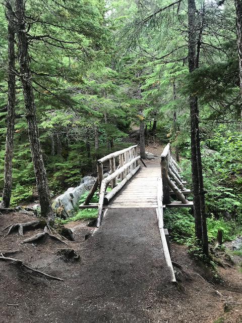
 One of my favorite spots is the bridge that goes over the rushing Campbell Creek as it pours down the mountain and eventually to a calmer existence in town.


