Showing posts with label Transportation. Show all posts

Monday, December 07, 2015

Why I Live Here: Our Mayor Stops The Bragaw Extension

On one side, opposing the extension of the road through the university land where moose and other animals traverse, where cross country skiers ski, and nature reins, mostly, were all the surrounding community councils, the people who live near by.  Also opposed were the local Assembly members representing the area where the road would be and the state representative for that area and the state senator for that area.

On the other side, supporting the road, were the Department of Transportation, that ignored all the public comment over a several year process to continue to plan for a road.  DOWL Engineering that had the contract for the citizen participation process.  And apparently lots of builders and developers who were big supporters of former Mayor Sullivan who requested the state keep the road and got it along with a $20 million allocation into the state budget at the last minute several years ago.  Providence Hospital, the University of Alaska Anchorage, and Alaska Pacific University in meetings closed to the public gave support, though we aren't sure how strong it was and what incentives they were given.

Even though the state state budget was facing drastic cuts for school and many other essential services due to falling oil revenues, the state kept this project that was opposed overwhelmingly by people in the neighborhood.

Well, it turns out that what one mayor gives, another mayor can take away.  Still fairly new Anchorage mayor Ethan Berkowitz last week pulled the city's support of the road.  The state, saying that without the local support, would cut the project.

Along Northern Lights very near where the road would have gone
Lots of people fought long and hard to stop this unnecessary road which would have cut through what I've been calling Anchorage's Central Park.  It's a big green swath in midtown by the Universities, that is wonderful recreation site, and a natural infrastructure project that cleans the air and the water,
as well as preserving water that would otherwise end up in sewers and go out to see.  It quiets the region and provides refuse for moose and other animals and birds.  Think I exaggerate?
Read E.O. Wilson's The Future of Life.

I asked three of last April's mayoral candidates whether they would stop the road if elected.  Candidate Berkowitz gave the strongest indication that he would.

I thank him for keeping this campaign promise.  This is a big deal for the future of Alaska.

The people who want to connect every gap in every road, the people who make money from cutting trees and building things where they were and the politicians they support will be back on this sooner or later.  But for now, we're ok.  A big victory in the many battles for preventing Anchorage from looking like every other overdeveloped urban center and for preserving the reason that many of us live here.

Friday, October 23, 2015

Why I Live Here - Chester Creek (Lanie Fleischer) BikeTrail

I had a workshop at Rural Cap yesterday and since it was sunny out I figured it would be an easy bike ride.  And it was though there were a few spots where the trail was icy - some bridges and along Gambell. 


Riding home, particularly, I was reminded how wonderful our trail system is, at least for those traveling in the areas there are these trails.  Right in the middle of the city you are out of traffic, away from buildings, in the woods, on a trail that serves not just recreational users, but also people going to work and other errands. 


Here's the lake just before you get to the tunnel under Lake Otis Parkway.   The ducks and gulls seemed to be enjoying themselves.


And here's the trail as it skirts Goose Lake and then gets to UAA.

As I rode along this route, I realized how infrequently I see this now that I'm not running any more.  I used to go on the first part of this trail twice a week and the other portion once a week.  While regular daily exercises have gotten me to the point where my Achilles tendon doesn't interfere with walking any more, I'm not ready to push it for running.  When I've tried, it's been a problem.  So I've switched to bike rides, and the best trail for that near the house is the Campbell Creek trail, not Chester Creek.  Also a beautiful trail, but they offer different experiences.  Chester, along this part, is more birch and Campbell is more small Spruce and Chugach views.

If you look carefully at the shadows in these photos, you can see it's late October.  The sun crosses the sky fairly low to the south and the shadows go to the north.  But it will get lower still over the next several months. 


Wednesday, September 16, 2015

Ferries First, Then Come The Bridges

Yesterday I had a chance to meet John Duffy, the former manager and planning director of Mat-su.  I asked him about his thoughts on the Knik Arm bridge and the ferry that has been a white elephant for the borough since building a ferry dock on the Anchorage side never happened.

His response was that the ferry was a good idea and the Knik Arm bridge is a bad idea.  But the comment he made that most caught my attention was that "there has never been a bridge built that wasn't preceded by a ferry."   He even volunteered to give me $100 if I could find one.

Did he have any backup evidence on this?  Is there a book on this?  An article?  Is there a way to find this on google without checking bridge by bridge?  He didn't know of any, but he said he just knew this because he worked in this area.  He did add that all the contractors who looked at building the Knik Arm bridge said that they needed a ferry to get supplies, employees, and inspectors across the gap while building the bridge, that they weren't going to do the five hour round-trip drive.  That made sense.

OK, I realize that while Duffy didn't initiate this project, he did inherit it and promoted it for a while. I'd never heard before that bridges don't get built unless there are ferries first.  If this is true, what does it suggest about the future of the Knik Arm bridge?  Duffy's role might give him an incentive to make it look like a good deal, but it also gives him some inside knowledge.  And, as I said, the idea that bridges don't get built unless there are ferries first is new to me, and I suspect to others.   Of the many projects in Alaska that haven't worked out, this one had acquired a pretty pricey boat for nothing and merely needed a port on each end - a minor task compared to, say the Knik Arm bridge project.  If people had supported it strongly, it could have easily happened.  The question is why, really, did the support evaporate?  (I don't have the answer today, but it's something we should be asking.)

But I'm am going to offer what I've found about the idea that bridges are always preceded by ferries.


Googling The Link Between Bridges And Ferries

So I started googling.  Things like 'bridges preceded by ferries,"  which got a number of articles about specific bridges in the US.  But I wanted a larger selection.  So I looked up "10 biggest bridges in the world."  That got me lots of the ad-laden list sites.  So I opted for Wikipedia which gave a list of countries and lists of bridges in those countries.  But they tended to only talk about the bridge and not what preceded the bridge.

I changed my strategy a bit.  Once I got a bridge name, I googled for the river plus crossing with ferries.  This got ferries for every bridge I looked up.  I've got those below.  Of the 15 or so bridges I looked up, I didn't find one that wasn't preceded by ferries.  That's a small sample size, but I looked at bridges in different parts of the world, old ones, new ones, big ones and small ones.  I also have examples of bridges crossing different bodies of water - mostly rivers, but also bays, lakes, fjords, and canals. 

A ways into my search, I did find a general statement about bridges and ferries (and fords.)

From an 1898 book titled Science and Industry, Vol II
"Barring these disadvantages, fords and ferries are adequate for the needs of a thinly settled community;  but, as population and traffic increase, there arises a demand for a safe and certain crossing of streams, whatever the state of weather and water.
This demand always precedes the bridge-building period."


Why Does This Matter?

Why am I making such a big deal about this?  We've got a well paid commission that is working to set up the Knik Arm bridge.  Many people think there is no need for such a bridge.  
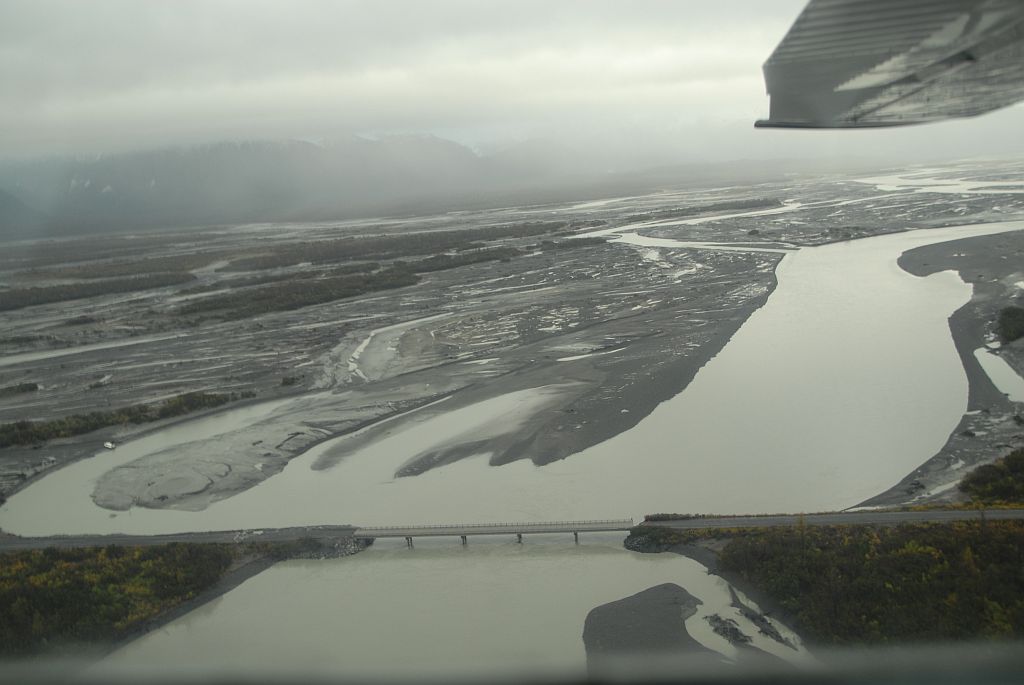
The Mat-su Borough attempted to develop a ferry at the same location.  They got a great deal on an experimental ship built by the US military and they built a ferry terminal on the Mat-su side.  But they couldn't get Anchorage to build a site on the Anchorage side.

Mat-su finally gave up and put the ferry up for sale.

I had assumed the Anchorage side didn't want the ferry because they were pushing the bridge and didn't want the competition.  But the point Duffy was making was that you need a ferry service to demonstrate the need before you build a bridge.  His point was that every bridge over water was preceded by a ferry.  The Science and Industry text says that outright, but it's an old text.  Below is a list of 15 bridges around the world.  Every one I looked up was preceded by ferries.

Not only are ferries, apparently, important as a first sampling test of the need for a bridge, but Duffy points out that to build a bridge, you need ferries to cross the body of water to take materials, employees, and inspectors.


15 Bridges That Were Preceded By Ferries

1.  SFChronicle:
"Ferries on the San Francisco Bay predate cable cars in the city by nearly 50 years, starting with John Reed, who ran a sailboat from Sausalito to San Francisco in 1826. His business didn’t last long. The American Indians, who paddled across the bay, were faster and much more reliable.
Regular ferry service started in 1851, and the popularity exploded in 1907, when several ferry companies consolidated into Northwestern Pacific (taken over by Southern Pacific in 1928). Southern Pacific’s 43 boats in 1930 were reportedly the largest ferryboat fleet at the time in the world.
The local ferry companies aggressively fought the construction of the Golden Gate Bridge and Bay Bridge, and they were financially smart to do so. The popular bridges mortally wounded the ferry business, and the final transbay ferry journey of the era was completed in 1958."

Before the Bridges: When ferry boats plied the river - See more at: http://www.wnypapers.com/news/article/featured/2015/02/21/119687/before-the-bridges-when-ferry-boats-plied-the-river#sthash.64ZHPgcL.dpuf
2.   Niagra Wheatfield Tribune    Grand Island, Niagra Falls NY
The push for Island bridges
Grand Island was purchased from the Senecas in 1815. Forests of oak trees drew settlers for the Island's valuable lumber. Farms then flourished and the Island became a popular summer resort with sprawling, gracious estates, private clubs and summer homes. It officially became a town in 1852. Two ferries provided transportation to and from the Island before the bridges were built. One launched from the former Bedell House in Ferry Village and the other from the site of the current Byblos Niagara Resort & Spa.
Luther's grandfather, Henry Long, went to Washington, D.C., in 1898 to make a case for bridge construction, but he died in 1925 without seeing his dream come true. A decade later, Island schoolchildren were bused to the South Grand Island Bridge for its grand opening, where noted urban planner Robert Moses and other dignitaries joined in the celebration in 1935. Grand Island Boulevard, then called the Express Highway, had been built in 1933-34, Luther said, to connect the two bridges. The Congregational Church was torn down to make room for the highway to come through. "The second set of bridges didn't come 'til the 1960s," she explained. "But there certainly wasn't the flow of traffic that we have now."
- See more at: http://www.wnypapers.com/news/article/featured/2015/02/21/119687/before-the-bridges-when-ferry-boats-plied-the-river#sthash.64ZHPgcL.dpuf
"The push for Island bridges

Grand Island was purchased from the Senecas in 1815. Forests of oak trees drew settlers for the Island's valuable lumber. Farms then flourished and the Island became a popular summer resort with sprawling, gracious estates, private clubs and summer homes. It officially became a town in 1852. Two ferries provided transportation to and from the Island before the bridges were built. One launched from the former Bedell House in Ferry Village and the other from the site of the current Byblos Niagara Resort & Spa.

Luther's grandfather, Henry Long, went to Washington, D.C., in 1898 to make a case for bridge construction, but he died in 1925 without seeing his dream come true. A decade later, Island schoolchildren were bused to the South Grand Island Bridge for its grand opening, where noted urban planner Robert Moses and other dignitaries joined in the celebration in 1935. Grand Island Boulevard, then called the Express Highway, had been built in 1933-34, Luther said, to connect the two bridges. The Congregational Church was torn down to make room for the highway to come through. "The second set of bridges didn't come 'til the 1960s," she explained. 'But there certainly wasn't the flow of traffic that we have now.'"
3.  Duluth 
1906 – 1910: Working Out the Bugs
In March McGilvray reported that the bridge had run perfectly since February 6, handling two hundred to three hundred teams of horses and thirty thousand people a day. He estimated the cost of operating the bridge, including the $4,000 in interest on the bond, at $10,578.31. It may not have been as big a savings from the ferry operation as anticipated, but McGilvray’s spin on the numbers illustrates the bargain that was the bridge: it cost the city “one-fifth of one cent per passenger for operation, maintenance, interest, and power.” He closed his report with a request for the city to install a telephone in the ferry car so its operator could call for help should the car break down in the middle of the canal. It was not granted.
4.  Idaho government webstie talks about ferries in Idaho
In the late1800’s there were hundreds of ferries operating throughout the state, but by the early 1900’s the business began to disappear.  With the population growing, it made sense to build bridges across the most traveled routes.  Once a bridge spanned the river, there was no need to have a ferry.
5.  Columbia River Bridge at Astoria, Oregon:
“The Columbia River span ended the last operating ferry service along the Oregon Coast Highway. The use of ferries at the mouth of the Columbia River began in 1840 when Solomon Smith, Astoria’s first schoolteacher, lashed two canoes together and carried passengers and cargo across the river.3 Ferries intermittently served the area into the beginning of the twentieth century. When the Columbia River Highway (US 30) opened a direct overland link between Portland and Astoria in 1915, automobile traffic through Astoria rose, creating pressure for more dependable ferry service. Seeing opportunity, Captain Fritz Elfving established the first commercial auto ferry service in 1921, when the Tourist I made her maiden voyage. For forty years ferries kept the traffic moving, but there were some drawbacks. For one thing, they were slow. In good weather the 4.5-mile trip took half an hour. Since the boats could hold only a limited number of vehicles, motorists often endured long waits in heavy traffic.”
6.  Chesapeake Bay.
Were there any Chesapeake Bay car ferries?
Why yes, there were once a number of ferries that crossed the Chesapeake, and they transported automobiles and trucks from one side to the other. They were quite popular for a time, actually.
As an example, the Virginia Ferry Corporation operated ferries that crossed the mouth of the Chesapeake Bay. They departed from Little Creek (on the border between Norfolk and Virginia Beach) on the western shore to Cape Charles and Kiptopeke Beach on the Virginia Eastern Shore. The heyday for this corporation wasn’t very long. It ran ferries in the years after World War II and into the 1960’s according to the Chesapeake Bay Ferries website.
A much longer ferry tradition existed further up the bay in Maryland. Ferries existed between Annapolis and Kent Island as early as the nineteenth century. They were probably carrying automobiles by the 1920’s or 1930’s according to the Roads to the Future’s Chesapeake Bay Bridge History. Several lines and operators existed between the Maryland Eastern Shore and the larger portion of the state. These included the Claiborne-Annapolis Ferry operated by a private company and the Sandy Point-Matapeake Ferry operated by the State of Maryland
Why aren’t there any Chesapeake Bay car ferries?
That’s another question I often see in my query logs. The answer is simple: Bridges. The Chesapeake Bay Bridge Tunnel opened in 1964, connecting the two shores of Virginia with an innovative combination of bridge and tunnel segments. Maryland also connected its shores with the Chesapeake Bay Bridge in 1952. They weren’t too original with the names, though. This one is just a bridge, no tunnel, as the name clearly states.
The ferries disappeared soon thereafter at both locations. They simply couldn’t compete with the bridges. It might take an hour or two to cross the Chesapeake Bay using a ferry after figuring in waiting, loading, sailing and unloading. It took just a few minutes to drive across a bridge, and travelers didn’t have to worry about sailing times either. Ironically the traffic on the Chesapeake Bay Bridge can get so bad on summer weekends that a ferry is starting to sound pretty attractive again.

7.   From Gulflive, the bridge at Fort Bayou, Mississippi:

Older generations know not to take for granted some of our modern bridges, especially the four-laned ones. In generations past folks often had to rely on ferries to cross bodies of water.
One of the earliest exits out of Ocean Springs was north on Washington Avenue across Fort Bayou. Franco's Ferry came to be operated there by 1875.

Quoting from a book by Chris Wiggins the article continues:
"Ferries came in all sizes and descriptions," wrote Wiggins. "For crossings on smaller bodies of water, a rope or cable ran from one bank to the other. "The ferry guided along this and was pulled by cranking on a winch. For larger crossings a ferry could be propelled by a boat and motor attached to the ferry and no permanently moored cable was required. This was the case across the Pascagoula River, from Gautier to Pascagoula.
"The ferry was operated under a license issued by the county, and public documents provide a record of the rates. In 1893 the fare was: one man on foot $.05, man and horse $.10, man and horse and cart $.15, each driven horse or cow $.02. Interestingly, when the first bridge was completed to replace the ferry in 1901 rates dropped for humans. A man on foot now cost only $.01, but herded animals didn't get a break."
Wiggins noted that the first Fort Bayou Bridge was worn out by 1929 and a new one was constructed. It, like the first one, opened and closed with a swinging span. In 1985, the third and now existing bridge was built. It opens with a draw-bridge (lifting) mechanism, a faster apparatus."

8.  Lake Washington (Seattle Times):
"IN 1939, THE COUNTRYSIDE EAST OF LAKE WASHINGTON WAS FOCUSED on the little market city of Kirkland. In town, chicken ranchers and dairy farmers could buy seed and feed, get a tooth pulled, and stock up on groceries. Every hour, the lake ferry's arrival pulsed trucks, cars and foot passengers through town. But five minutes outside of Kirkland, the Eastside grew sleepy, almost primitive, dotted with worn farmhouses along muddy lanes. The King County Housing Authority worried about rural poverty on the Eastside -- ramshackle houses and poor sanitation.
    To the south, Bellevue was not really a town at all in 1939. "There was no 'there,' there," joked locals, thinking of the handful of stores along Main Street and the endless fields of berries and vegetables. Bellevue was a sprawling, unincorporated district best known for its Strawberry Festival. Along the lakeshore, there were a few elegant homes amid the rustic summer cottages of Medina and the Points -- the Gold Coast of the future.
    But from Bothell to Renton, lake to mountains, the Eastside dozed on gentle country time.
   As the 1940s began, two events awakened east King County to different futures: construction of the first bridge to span Lake Washington and dramatic industrialization of the Houghton lakeshore, in what is now south Kirkland. The revitalized Lake Washington Shipyards would skyrocket on the wartime homefront, only to sputter and fade. But the bridge would turn the Eastside toward a suburban future, and pulled the momentum of growth south from Kirkland to Bellevue."

9.  Istanbul - crossing the Bosporous, from Wikipedia:
Boats have traversed the waters of the Bosphorus for millennia and until the opening of the first Bosphorus bridge in 1973, were the only mode of transport between the European and Asian halves of Istanbul. They continue to serve as a key public transport link for many thousands of commuters, tourists and vehicles per day.

10.  Khabarovsk, crossing Amur River, from Wikipedia
In 1916, Khabarovsk Bridge across the Amur was completed, allowing Trans-Siberian trains to cross the river without using ferries (or temporary rail tracks over the frozen river in winter).
11.  Panama Canal -  Bridge of the Americas, from Wikipedia
"From the beginning of the French project to construct a canal, it was recognised that the cities of Colón and Panamá would be split from the rest of the republic by the new canal. This was an issue even during construction, when barges were used to ferry construction workers across the canal.
After the canal opened, the increasing number of cars, and the construction of a new road leading to Chiriquí, in the west of Panama, increased the need for some kind of crossing. The Panama Canal Mechanical Division addressed this in August 1931, with the commissioning of two new ferries, the Presidente Amador and President Washington.[2] This service was expanded in August 1940, with additional barges mainly serving the military.
On June 3, 1942, a road/rail swing bridge was inaugurated at the Miraflores locks; although only usable when no ships were passing, this provided some relief for traffic wishing to cross the canal. Still, it was clear that a more substantial solution would be required. To meet the growing needs of vehicle traffic, another ferry, the Presidente Porras, was added in November 1942.  [emphasis added]

The Bridge Project

View on Bridge of the Americas
The idea of a permanent bridge over the canal had been proposed as a major priority as early as 1923. Subsequent administrations of Panama pressed this issue with the United States, which controlled the Canal Zone; and in 1955, the Remón-Eisenhower treaty committed the United States to building a bridge.
.  .  .
The inauguration of the bridge took place on October 12, 1962, with great ceremony.

12.  The London Bridge:
"Until Medieval times, the only way to cross the Thames from London on the north bank to the southern suburb of Southwark was by ferry or a rickety wooden bridge. In 1176 all that changed. After successive wooden bridges were destroyed by fire, Henry II commissioned the building of a permanent stone crossing. It took 33 years to complete and was to last – give or take repairs and remodelling – more than 600 years."
I kept looking for different bridges to see if I could find ones that didn't have ferry service first. I looked up bridges built after 2000 to see if new bridges were different.

13.  I found a bridge in Fort Lauderdale, Florida - the 17th Street Bridge - and the history didn't talk about a ferry, but when I looked up "Broward County ferries" I found this
"The fort was later moved to Tarpon Bend, and then to the barrier island near present-day Bahia Mar. A trading post established in the 1890s by Frank Stranahan (1864-1929) at a ferry crossing of the New River became the nucleus of the city of Fort Lauderdale.[3]"
 I don't know that that specific bridge in Fort Lauderdale had a ferry first, but crossing the New River was first done by ferry.   I don't think this bridge will get me Duffy's $100.

14.  I looked for African bridges and found the Mkapa Bridge between Tanzania and Mozambique.
After a lot of poking around I found this (not quite grammatical) evidence that it was preceded by ferries:
"El Nino resulted in a severe flood in 1998 causing considerable loss of life and property
and use of   government rescue helicopters. The Tanzania Essential Health Intervention
Project (TEHIP) as did construction of a tarmac road from Ikwiriri to Mkapa Bridge
which imporvied [sic] the economy of Ikwriri and saved lives and property, the bridge had severe consequences for businesses and livelihoods dependent on the old ferry service." [emphasis added]

15.  Here's a bridge I randomly picked from the Wikipedia list of bridges in Norway:
"Ship services in Nordhordland started in 1866, and in 1923 the first car was purchased.[5] A car ferry service between Isdalstø in Lindås and Steinestø in Åsane on the mainland was established on 7 July 1936.[6] A plan was launched whereby all traffic from Nordhordland would be collected in one place and transported across Salhusfjorden to Åsane. By moving the ferry quay from Isdalstø to Knarvik, the length of the ferry service could be reduced. However, the fares would be kept the same and the extra revenue used to finance a bridge from Flatøy to Lindås.[7] This allowed the Alversund Bridge to open in 1958, and the ferry service from Flatøy and Meland to move to Knarvik."

Some Possible Exceptions

Finding a bridge that wasn't preceded by a ferry is a little like looking for the black swan.  Not finding one doesn't prove they don't exist and there are too many bridges in the world for me to check them all.

There may, however, be some categories of bridges that were not preceded by ferries.  I was looking at a bridge over a man-made lake (caused by building a dam) in Malaysia.  While I can find evidence that there are ferries on the lake, they appear to be more for tourists than traffic.  But I haven't been able to find out how people crossed the river that got dammed before the dam. Probably by ferry in the beginning.  But so far haven't been able to document that.  The river that was damned was the second longest in Malaysia.  But there was a river there before the lake and there was a road. And the road had to cross the river.  Maybe an old bridge and before that a ferry?  Needs more research. 

I also checked on the bridge over the River Kwai in Thailand.  I can't find any real evidence that there was or wasn't a ferry over the river.  But it's possible this part of this river had no ferry.  Since it was used by the Japanese to make a shorter route from Thailand to Burma, they weren't serving local travelers, and weren't concerned about traffic over the bridge, or about the cost of the bridge.

The second case is not a model one would use to justify a bridge without having a ferry first.  The cost of the whole railroad (including this bridge)  in human lives and suffering  resulted in 
"111 Japanese and Koreans. . . tried for war crimes because of their brutalization of POWs during the construction of the railway. 32 were sentenced to death.[3]"[Wikipedia]

I imagine there might be some bridges built out there that didn't have ferries first.  But I'm guessing those bridges were built not to meet the needs of the local folks but of some others who would be advantaged by the bridge.  Like the Japanese railroad bridges in Thailand in WW II.   And I'm guessing like the Knik Arm bridge here in Anchorage.

Wednesday, August 05, 2015

San Francisco Shots


There are lots of flowers and greens growing surrounded by cement.  Childhood memories always bring a smile when I see a blooming agapanthus.


This building commands attention.  It's an auto repair shop today.  Fortunately the address is prominent and I was able to find out more about this building.


From part of the description of this building at 3536 Sacramento in The Early Public Garages in San Francisco : 1906 - 1929 - An Architectural and Cultural History by Mark D. Kessler:
"As at Pine Street, all of the implied displacements - both vertical and horizontal - serve to highlight the most vacuous but important part of the facade  - the entrance.  Other facades of brick box garages celebrate entrance through the use of a singular, summary gesture - an arched portal beneath a gabled parapet.  By contrast, the designer of this facade pursues a fine-grained regulation of proportion, composition and motif in order to achieve this end.  This facade is remarkable for the aggregation of small-scale brick details into a unified composition that represents a simple cross-section.  The brick detailing is charming and varied, dense and delicate.  Small-paned windows, gauged brick lintels, corralled verticals, and basket-weave infill impart to this facade a surprisingly convincing residential character.  Located on a shopping street in a residential neighborhood, this building is contextual and striking."
And according to Yelp,  Leonard at Botta's auto shop's service is a good as the architecture.  This review reflects the positive experiences noted in all the other comments, though this one's prose is a little more creative:
"Got my bumper fixed here after a neighbor disregarded my car's personal space. Communication, scheduling, and drop off/pick up was easy and efficient. They communicated with my insurance (USAA) and the rental car place (Enterprise) and I didn't have to worry about a thing.

Picked it up and had a  beautiful fresh bumper (and a clean car- which was an awesome surprise). Unfortunately, another neighbor (I'm assuming it wasn't the same neighbor - that'd be really bad car-ma) must have gotten jealous, because the next morning, there were more scratches :( Ugh, my car is looking forward to moving out of the city.

Anyway, I let Leonard know and since he had leftover paint from my car that was still useable, he had me come by and he touched it up for free, which I REALLY appreciated. Would definitely recommend taking your car here. Great customer service."


The Civic Center BART station.


Jane cafe and bakery.


This was at a driveway at a fitness center.


The doors at the Central Seventh Day Adventist.


I'll do another post on April in Paris where I took this picture.  This is a preview.  Do you see the bee?

Friday, July 17, 2015

Life After Death: Random LA Shots

My mom was 93 and we've been able to spend a lot of time with her over the last two years as she lost her mobility, but not her wit.  She never wanted to be 'kept alive' and she was able to stay in her home with the help of a full time caregiver and our monthly visits.  She flunked the hospice test twice - including last May.  But this time she qualified as her body was starting to shut down and she stopped eating and drinking.  And even though it's expected, and it's at the end of a long, interesting, and very productive life of service to others, it's still the final, irrevocable cutting of ties to the past.

So we're doing our best to enjoy the memories as we start cleaning up things she wouldn't let us throw away while she was alive.  I understand.  She knew where things were.  Really, she'd tell me exactly where to find things.  But there were also way too many old plastic containers, pens, old papers, dried pussy willows, and bars of soap.  And so now we're trying to take stock of what there is.  What needs to go, what's still good.  We're reading old letters and the deed to the house, finding little surprises everywhere.

The rest of this post is just some pictures I've taken as we run our errands around LA with a little bit of commentary.

I was coming back from a bike ride to the beach to clear my head.  I couldn't imagine how this car got squeezed between the wall and the light post.  Someone told me another car, removed already, had been speeding down Pacific.  I'm guessing it clipped the front of this one and pushed it into there.  It was only a little later that I realized that I'd been right there on my bike not more than 30 minutes before this happened on the way to the beach.  And people think riding in the street isn't safe.


This iris was blooming outside my mom's window the day she died.


I was so relieved to learn I could get gluten free vodka!


I remember being impressed with the irony of this sign when I was a young kid.  It's still up in the garage 50 some years later.


We had to go downtown to get death certificates.  It took less time to fill out the application, wait in the short line, and have them printed, than it did to listen to the whole taped message on the phone so I could talk to an actual person to see if they were ready to be picked up.  Phone service - moderate.  In person service - excellent.  LA County Health Department.

After passing a parking lot where you could park for $4 for the first ten minutes, finding a meter that cost only fifty cents per hour seemed like a deal.  Plus it was right next to Mexicali restaurant, a modest but delicious lunch spot.  Here's the array of salsas. 


Korea Times - click to read more clearly


Since things went so much faster than expected at the health department, we took a leisurely ride along Wilshire Blvd to the attorney's office.  We passed the old Ambassador Hotel where Robert Kennedy was shot.  It now has a Robert Kennedy park in front and what looked like a school where the hotel was.  Across the street was a sign for the old Brown Derby, but the derby shaped building was gone.  The magnificent art deco Bullocks Wilshire department store now houses Southewestern Law school.

Korea Town edges into Wilshire as well and this sign for the Korea Times seemed a good reminder of how cities evolve.  


Here's an unfinished metro station near the LA County Museum of Art, as the subway is finally reaching west after years of opposition from Beverly Hills folks who didn't want to give the riffraff an easy way to their neighborhoods. 


And here's a lantana that I grew up with and is still blooming after so long.  But I didn't know that it was poisonous.  From the Illinois Veterinarian Medicine Library:
"Lantana (yellow sage) is a native of tropical Americas and West Africa. In the northern states including Illinois, it is grown as a garden annual reaching 12-18 inches tall . In the south, from Florida to California, it grows as a perennial shrub of 3-6 feet tall. In the tropics, it may grow even taller. Leaves are opposite, ovate, 1-5 inches long and 1-2 inches wide, with very small rounded teeth, somewhat rough and hairy. Leaves are aromatic when crushed. Flowers are borne in dense clusters 1-2 inches across on the axils near the top of the stem. Each flower is tubular with 4 lobes flaring to about 1/4 inch, initially yellow or pink gradually changing to orange and deep red. Often, the different colored flowers are present on the same cluster. Fruit is fleshy, greenish-blue to black, and berry-like with each containing one seed."
I didn't know it was poisonous:
"Animals in pastures with sufficient forage will often avoid Lantana, perhaps because of its pungent aroma and taste, but animals unfamiliar to the plant may ingest enough to affect them. Fifty to ninety percent of animals newly exposed may be affected. Foliage and ripe berries contain the toxic substances with the toxins being in higher concentrations in the green berries. Species affected include cattle, sheep, horses, dogs, guinea pigs, and rabbits (Ross, Ivan A. Medicial plants of the world. Totowa, N.J.: Humana. 1999. p. 187.)"

Thursday, May 21, 2015

It's Not A Cristo - It's Lanie Fleisher Chester Creek Bike Trail Construction Closure

I noticed - how could I not - the orange material on the edge of the bike trail as I rode home yesterday from the LIO.  It looked like pretty nice material, but it didn't really look like a Christo art installation.


Yesterday on the way home there were some construction folks so I asked.

They are, if I understood this right, going to take out the old bike trail and completely redo it with jogging paths along the sides.  The trail certainly could use some repairs, but I couldn't help but think that they would close down the major streets completely for repairs all summer, and the Chester Creek bike trail is the Seward Highway of bike trails in Anchorage.  He said there'd be detour signs and routes.  We'll see.

I asked how long it would take.  He's got 70 days he said.  That's most of the summer here in Anchorage.  They'll do it in sections, he told me, so it won't all be closed at once.  It would be nice if they did this continuously - one short section per summer - and when they were done after, say ten years, they'd start over to keep the trail in good shape.  But I guess securing money over time like that isn't likely.

Anyway, I understood that the portion that's got the curtains - Maplewood west to near the Juneau Street spur - will be shut down on Tuesday for work to begin.  Actually, probably from Lake Otis west. 

I didn't know anything about this, but I found the plans online.  It seems they sent out notices to people who live along the trail.  But lots of folks use the trail who don't live along them.  Signs along the trail might be a good way to let cyclists, runners, and other trail users know about the planning phases.

Here's a link to the written documentation.  It's not at all clear which parts they will do when.

Here's a link to the maps documentation.  Again, not terribly clear about timing.

This is a huge file, so you can click on it and see it much bigger
Phase 1 was completed last summer.  It's beyond my regular routes, so I didn't notice.  

The whole project this summer goes from Arctic to the Arc (near Debarr).  The section near the Arc really, really needs to be repaired.  The roots damage there is horrendous.  And where I was, there are regular big bumps where the asphalt has contoured around pipes underneath. 

Friday, May 01, 2015

Q: When's The Cordova Road To Child's Glacier/ Million Dollar Bridge Going To Be Ready? A: It's Not.

Alaska DOT Photo
We had taken the road at the end of July 2011.  The road was closed in August 2011.   On November 23, 2011, I published this post:  Road to Child's Glacier and Million Dollar Bridge Closed Until after 2015.    I recently realized, hey, it's 2015.  I should check on whether the road was ready yet. 

So I emailed the Department of Transportation and got this quick reply:
"Hi Steve,
The bridge is still standing, but the approach to the bridge washed out with the shifting of the Copper River.

There is no plan at this time to rebuild the bridge, we just don't have the construction dollars available.

Please let me know if you have additional questions, or need more information.

Details on the bridge are available here:  http://dot.alaska.gov/nreg/bridge339/

Best,
Meadow Bailey"   (emphasis added)

The link takes you to this undated (Meadow emailed again and said it was 'this winter' so after the March 2014 link below)  announcement:

Copper River Highway Copper Delta Bridge #339

There has been a recent decision to close the project due to the lack of funding for design or construction.
History
The 56-mile Copper River Highway begins in Cordova and ends at the Million Dollar Bridge. The road provides access to vast areas of the Copper River Valley, is used frequently by hunters and recreationists, and potentially supports proposed resource development.
Bridge No. 339 is one of 11 bridges crossing the Copper River Delta. The bridge was constructed in 1977. The hydraulic design of the existing bridge was based upon a predicted flood event of 21,300 cubic feet per second (159,300 gallons per second).
Naturally occurring changes in flow between river channels across the delta led to a dramatic increase in the amount of water flowing under Bridge No. 339. This increase in flow was first noticed in 2009. In 2010 ADOT&PF along with the U.S. Geological Survey began a comprehensive monitoring program at the site. During the summer of 2011 the flow was measured at 89,000 cubic feet per second (665,800 gallons per second).
Early in 2011 a project was created to investigate ways to reduce flows and preserve the bridge. However, field measurements revealed that the increased flow has scoured away 50 feet of the river bed under the bridge. The scour has compromised the vertical and lateral structural capacity of the bridge piers and abutments. These conditions constitute structural failure of the bridge, requiring that it be closed.
Did you read carefully?  The bridge was built in 1977 "based upon a predicted flood event of 21,300 cubic feet per second (159,300 gallons per second)."  You can compare that to how many gallons per second go into your car at the gas station.

However, in 2011, the water flow (presumably a regular event, not a flood event) was 89,000 cubic feet per second (665,800 gallons per second)."   That's almost five times greater.   


And this DOT page has links to other updates, including a three page pdf in March 2014 that says, among other things:

  • "There are two different bridge options
    • Option #1
      Decked Bulb-Tee Girders on Drilled Shaft Piers.
      Estimated construction cost: $66,250,000
    •  Option #2
      Box Girders on Pipe Pile Extension Piers.
      Estimated construction cost:  $50,700,000"
  • "During the winter the road beyond milepost 16 is not maintained and is closed to vehicle traffic (typically November thru mid April).  The 2010 summer Average Daily Traffic Volume (ADT) at Bridge 339 was 65."  So, if we count summer as mid April to November 1
That means, say if summer is from April 15 to October 31, we'd have 168 days times 65 cars or a total of about 10,000 cars, which would mean, for one summer, each car crossing the bridge would be, using the cheaper bridge, about $5000.  And over 30 years - the life of the original bridge - at the same rate, the toll for each car would reduce to about $160 per vehicle.  (And this doesn't consider maintenance and repairs.)  Of course, other roads and bridges in Alaska aren't calculated this way.  It might be interesting if they were.  Say, how much would that road from Juneau to the mine they want to build cost per vehicle over 30 years? 

But there's more:
  • "Since the bridge was closed in August of 2011, the river has continued to migrate east, washing out an additional 1,000 feet of the Copper River Highway.  Erosion is now threatening Bridge No. 340 located 1,100 feet east of Bridge No. 339."  

In any case, anyone  who knows about the price of oil and the state of the Alaska budget knows neither of these options is going to happen any time soon.

If you want to get out to the Million Dollar bridge or to Child's Glacier, which in 2011 had a beautiful campground, you're going to have to go by boat or float plane.  

Wednesday, January 28, 2015

LA Parking Ticket Follow Up #2 And More LA Driving Hazards

As I was going through my mom's bills and other mail, I found an envelope from the LA Traffic Enforcement Division.  It was dated Jan. 22, 2015.  I had sent in an appeal which the post office tracking system said had  arrived on Jan. 16.  That's six days before the notice.  The notice said my mom's car had gotten a parking ticket that needed to get paid.

So I called the number and after a fair amount of "if you need X, press 1, if you need Y, press 2" runaround, I finally got to talk to Edwin.  I explained the appeal date and the notification date.  He took the violation number and looked it up.

Edwin:  We received your appeal and it was decided and the decision was sent to your out of town address on January 23.  (We came down here on January 24.)
Steve:  I'm in LA now and so I can't see my Anchorage mail.   Can you tell me the decision?
Edwin:  The appeal was approved.  The violation is removed.


Well, that was good news.  The ticket's gone.  Chalk one up for reason and justice.   I'd like to think it's because I wrote a sensible appeal letter.  (Basically what I posted, but desnarked.)  But it might just be the 'Alaska card.'  People tend to be nice to people from Alaska, like they think living there is enough suffering.   Or maybe they're dismissing a lot of violations now because there have been so many complaints and because the City Council is trying to get them to simplify the signs.  Whatever the reason, it was nice.

After my previous posts on this, someone sent me a link to a story about a design student who got a parking ticket in LA and designed a sign that should be easier to figure out - well it takes a minute or two to adjust, but it does look like a much better idea than what they use now.


Then, I opened the next envelope.  It a "Notice of Toll Evasion Violation."


Where was I January 2?  That was the day we drove out to San Bernadino to visit our former Alaska friends.  We used the carpool lane when the other lanes stopped moving.

I went to the website  listed in the notice.   It turns out that some of the carpool lanes are actually toll roads and that you need to sign up and pay ahead and they give you a little transponder to put on your car and it deducts the toll for using the road.  I had no idea.  I did see such things in Singapore  (you can see the ERP signs and a transponder on a dashboard near the end of the pictures in this post from 2008), but I didn't know that they had them here.  As you can see it was pretty dark at the time.  It said you could sign up and get a transponder and pay in advance and the fine would be applied to the purchase.  But I really didn't need one.

So I called them.  I talked to someone I thought said his name was Dorman, but maybe it was Norman.  He listened to my story and my question about buying a transponder and he said, that since I was from Alaska it didn't make sense to buy one and that he'd waive the violation this time.  I'm guessing that happens all the time, though I suspect a lot of times it's rental cars.

I did ask if all the carpool lanes required such a pass and he said no.  Only if it says EXPRESSLANE or FAST TRACK.

The website says it's an experiment and that the grant funding would run out Feb. 2014.  I guess the experiment worked because they're still using it.  But they haven't updated the website to say what happened after the funding ran out.


I can't wait for cars that drive themselves and have all the rules programmed into their computers.

Wednesday, January 07, 2015

Quick Seattle Stop

Got to spend a couple of hours with my little shark on the way home.  Including a quick look around at the aquarium.  The octopus was putting on quite a show, I was fighting low light and reflections on the glass.


We left early from LA and it was clear until just before Seattle.  We were in the cloud until a couple of seconds before landing.


Not sure what promotion this plane was about.


Fare enforcement checked tickets and he spent a long time talking to the lady in the center who had just barely gotten on with her stroller and baby.  I was thinking, she was happy when she made the train, but maybe not so much now.  But they seemed to settle whatever it was amicably.  She did have to show id.  


By 3pm the fog was gone, the sky was blue, and the air was clean and not really cold.

So I was busy today and only have a short time to post a little bit before boarding.  But I did see the front page of the ADN and hope to comment on the Pierre McHugh's new job as well as the governor's telling Gasline Commissioners not to sign the non disclosure agreement.   


Tuesday, January 06, 2015

Inside The Disney


Sunday we went to a concert at the Disney Concert Hall.  I've loved this Frank Gehry building from the first time I saw it, but we'd never been to a concert there.  Here's an earlier post with more pictures of the exterior.


A Sunday afternoon concert also gave us an opportunity to try the
Expo line from Culver City to downtown for the first time too.


We quickly rode along Exposition past USC and the Coliseum and various museums at Exposition Park and were in downtown in less than 30 minutes.  Here's the Pico stop at the Staples Center.  We got out at the 7th St. station and walked around downtown.


I just liked this address.  They're big.  And 8's are  good luck in Hong Kong.


We walked by the LA Police Department - the sign says

#BLMLA Demands:
  1.  The immediate firing of the the officers who killed Ezell Ford
  2.  The Immediate filing of murder charges by DA Jackie Lacy
The curb says “Trees Matter - this concrete is illegal - Let us grow."


Eventually we were inside the Disney.  I loved the hall and the acoustics were great.  I wasn't expecting too much from the concert - a New Year's Concert Salute To Vienna - which seems now to be a syndicated package of concert entertainment, piggy backing off the live concerts from Vienna.  The program lists groups of singers, dancers, and conductor going to various US cities.  One group to Philadelphia, New York, New Brunswick, Scranton, and DC.  Another to Coral Springs, West Palm Beach, and Miami.  Yet another to Florida - Clearwater, For Myers, and Sarasota.  One to San Diego and LA.  And one concert in Austin.  But the music in the hall sounded good and I was particularly taken by the voice of baritone Thomas Weinhappel.


Here's the orchestra warming up before the concert.


Then we left and took the train back to Culver City and drove home.


Can you tell I'm rushed?  I've got a bunch of posts and other tasks open but not finished.  The cold LA weather has changed to hot again.  And we're getting ready to head home.  Lots to do.

Saturday, January 03, 2015

Something To Chew On While Squeezed Into Coach When It's A Toasty 0˚ Out

A few things I ran into or got sent my way lately that are worth thinking about.


1. Why Airlines Want to Make You Suffer  BY 

"JetBlue distinguished itself by providing decent, fee-free service for everyone, an approach that seemed to be working: passengers like the airline,  and it made a  consistent profit. Wall Street analysts, however, accused JetBlue of being “overly brand-conscious and customer-focussed.” In November, the airline, under new management, announced that it would follow United, Delta, and the other major carriers by cramming more seats into economy, shrinking leg room, and charging a range of new fees for things like bags and WiFi."

Wu argues that it pays airlines to make you suffer so passengers have to pay to suffer less - buy food, buy an aisle seat, buy a digiplayer, etc.  With all the flying we've been doing to visit my mom, we've enjoyed the benefits of 'elite status' on Alaska Airlines.  But that will end eventually and we'll become cattle again.  And Alaskans don't really have the options like driving,  or taking  buses or trains.  A key point in the article is the lack of competition.  Probably the most evil aspect of all the airline charges for me is the change fee.  It's totally gouging the flier.  If you change online, it costs the airline nothing (or practically nothing.)  And since most flights are full anyway nowadays, changes won't cost them seats, especially if they graduate the fee from nothing to something the week before the flight.  And the anguish they cause people who want to change, but would take a big financial hit if they did, is real.  It's one of those "just because we can" fees.


2. S sent me this long Outdoors article on how fake meat is going to revolutionize eating, save energy, and reduce global warming.
"I dumped meat a few weeks ago, and it was not an easy breakup. Some of my most treasured moments have involved a deck, a beer, and a cheeseburger. But the more I learned, the more I understood that the relationship wasn’t good for either of us. A few things you should never do if you want to eat factory meat in unconflicted bliss: write a story on water scarcity in the American Southwest;  How much shit is in my hamburger?'; watch undercover video of a slaughterhouse in action; and read the 2009 Worldwatch Institute report 'Livestock and Climate Change." [UPDATED Jan 23, 2020:  Thanks to reader Lisa for alerting me that this link was no longer working and supplying another place to find the report.  Link fixed for now.]


It has cameo parts by Bill Gates and NY Times food writer, Mark Bittman.  It focuses on Beyond Meat where they are rethinking how to get the taste and texture of meat from plants.  As a mostly vegetarian who believes the meat industry is bad for animals and bad for the environment and for consumers' health, this all sounds like good news.  But there's still a part of me that knows that every solution has its own new problems. 


3.  Another unfortunate layout design in Alaska Dispatch News this week.   Do I even need to explain why I think this photo should not be next to this headline and story?  As a blogger I understand how easy it is to miss this sort of thing.  This is just friendly teasing.  But it's two like this in two months.  
*The screenshot is from the online version of the paper edition that you need a subscription.


4.  And the Los Angeles Times had a front page article on Anchorage's first year with no temperatures below zero degrees.  The title, "Temperatures in 2014 were too toasty for Alaska,"  reflects Outsiders' wit when it comes to Alaska.    Never mind that no one in Anchorage thinks of 0˚F as toasty, except maybe after two weeks of  -20˚, which hasn't happened in many, many years.  The point isn't that it's toasty, but that the warming temperatures, which anyone who's lived in Alaska for 20 years or more can attest to, is changing everything from when we plant in the spring, to the amount of ice we have to deal with on sidewalks and streets, and the wildlife we see, and the disappearing acts of nearby glaciers..  Throughout the state, it's melting permafrost, which, besides affecting roads and structures built on permafrost, also is beginning to release methane.On the positive side, that stereotypical impression keeps people from moving to Alaska.
It's also interesting that while the Alaska weather, cutesy headline and all, was on the front page, a more prosaically titled article, "California was Warmest in 2014" showed up on page 3 of the California section of the paper.  (Actually, the online version I linked to shows that the Times does like the word "Toasty" when talking about weather.)